Home / Washington / Seattle & Puget Sound / Billy Frank Jr. Nisqually National Wildlife Refuge
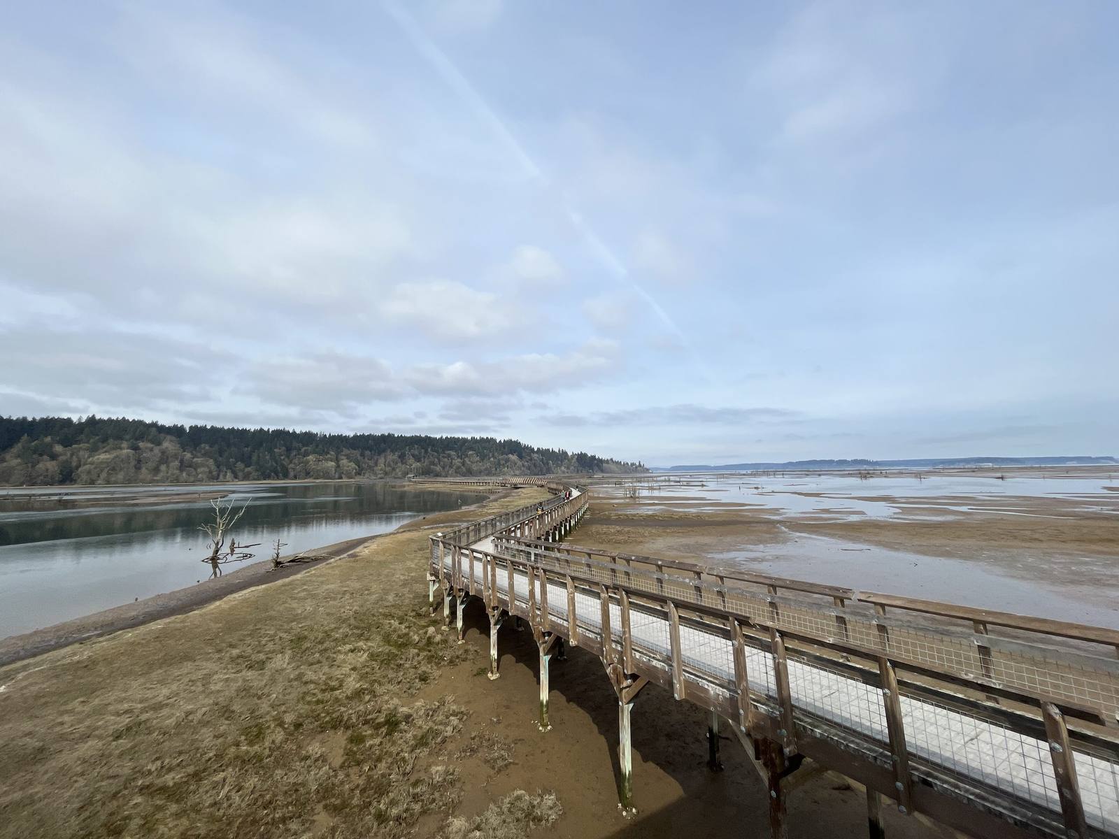
The elevated boardwalk running out across the tidal flats and channels of the Nisqually estuary under a pale spring skyUSFWS / public domain via Wikimedia Commons
🌲Natural

Billy Frank Jr. Nisqually National Wildlife Refuge

Part ofSeattle & Puget Sound

A delta given back to the tide in 2009, and named for the Nisqually fisherman who was arrested more than fifty times for fishing his own river.

Year-RoundFamily-FriendlyNative American HeritageHiking
⏱
Duration
One to three hours.
📅
Best Season
Year-round; winter for waterfowl, spring for migrating shorebirds.

The Story

The Nisqually comes down off the glaciers of Mount Rainier and spreads into a delta at the south end of Puget Sound, one of the least developed river mouths left on the Sound. Around the turn of the twentieth century a farmer named Alson Brown diked the salt marsh to make pasture, and for a hundred years the tide stayed out. In November 2009 the refuge took the dikes down, and salt water came back over 762 acres. The boardwalk that opened in 2011 runs about a mile out across the restored estuary toward open water, over channels the salmon use again to feed and grow before they go out to sea.

Billy Frank Jr. grew up a few miles upriver at Frank's Landing, a six-acre piece of Nisqually land on the river. He was first arrested for fishing there in 1945, at fourteen. Through the fish-ins of the 1960s and early 1970s, when Nisqually, Puyallup and other treaty fishermen set their nets in defiance of state game wardens, he was arrested more than fifty times, and the confrontations on the riverbank were sometimes violent. The question went to federal court, and in February 1974 Judge George Boldt ruled that the treaties of the 1850s guaranteed the tribes half the harvestable salmon.

He spent the rest of his life on salmon and their rivers, and he was among those who pushed for the dikes here to come out. He died in 2014. In December 2015 Congress renamed the refuge for him and designated the treaty ground inside it Medicine Creek Treaty National Memorial.

Visitor Info

⏱
Time Needed
One to three hours.
📅
Best Season
Year-round; winter for waterfowl, spring for migrating shorebirds.
🛣️
Highway
I-5

On the Map

Nearby

The closest stops worth working into your route

historical18 mi away
Tacoma Chinese Reconciliation Park
A waterfront park near the site of the Chinese settlement Tacoma's mayor and leading citizens marched out of town on November 3, 1885.
cultural38 mi away
Duwamish Longhouse and Cultural Center
The only longhouse in Seattle, built by the people the city grew up on top of, on land they bought back themselves.
historical39 mi away
Bainbridge Island Japanese American Exclusion Memorial
A cedar wall running down to the dock where the first Japanese Americans were taken, and the story of the island newspaper that wanted them back.
historical46 mi away
Old Man House Park
An acre of beach on Agate Passage where the largest winter house on the coast stood until the government burned it in 1870.
historical50 mi away
Paradise and Sluiskin Falls
The meadows on Rainier's south slope, and the waterfall named for the Yakama guide who took the first climbers to the snow and would go no farther.
geological58 mi away
Coldwater Lake
A lake that did not exist before 8:32 on the morning of May 18, 1980, below the ridge where the geologist David Johnston radioed his last words.

Historical markers nearby

Roadside plaques and monuments within a short detour

Marker24 mi away
Mount Rainier
Marker27 mi away
Hood Canal