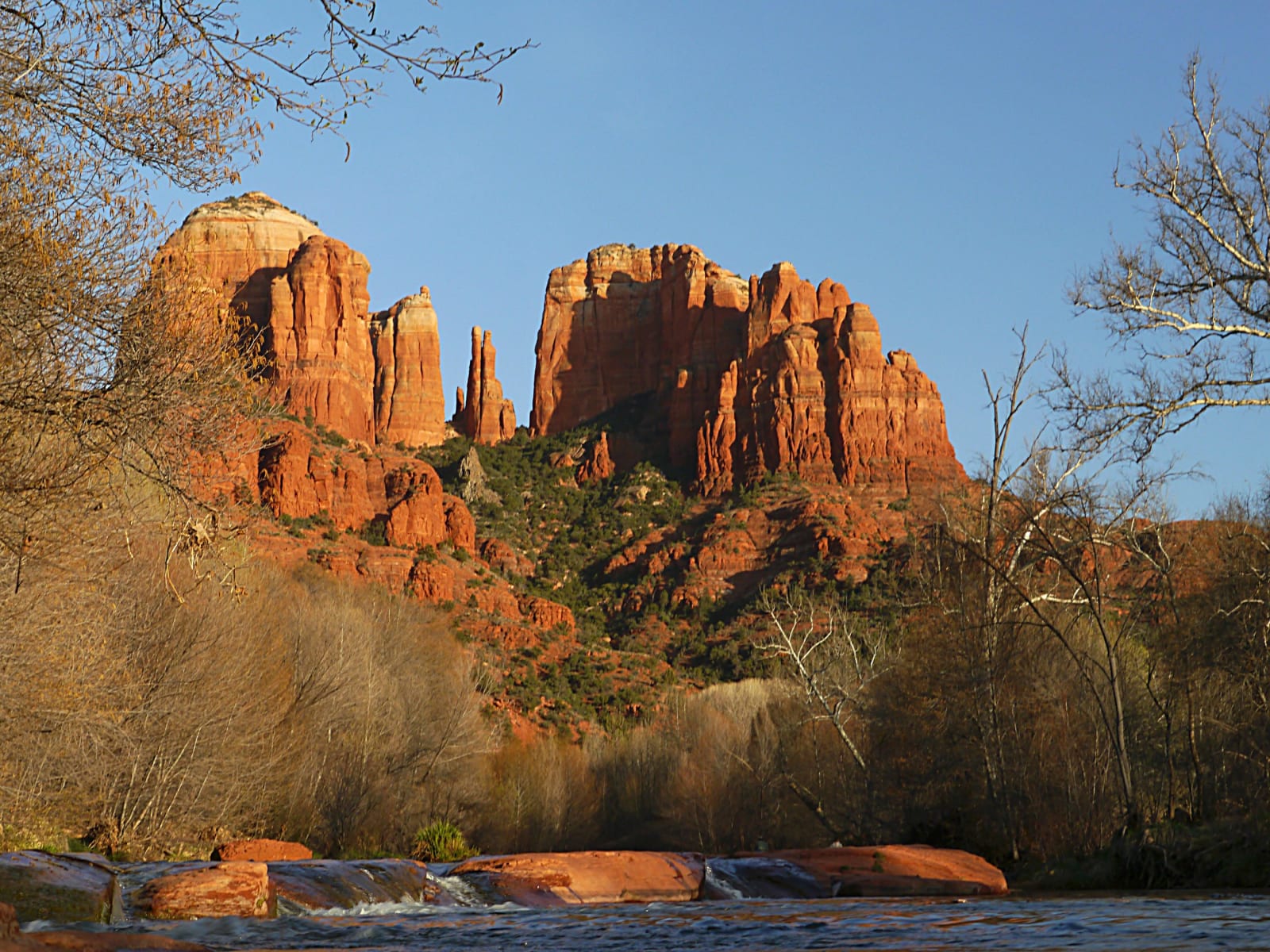
Cathedral Rock above Oak Creek in the red-rock country south of Sedona, its buttresses and spires lit warm by low sun against a clear sky, stacked red sandstone with a pale cream band along the upper walls and juniper and scrub holding the talus below. Bare winter sycamores stand at both edges of the frame, and in the foreground Oak Creek slides over flat shelves of red streambed rock in low winter flow.
Terrydarc / CC BY-SA 3.0 via Wikimedia Commons
Arizona · Region

Red Rock Country & the Central Highlands

Arizona's red-rock center — Sedona's sandstone spires and the green Verde Valley below, the copper ghost town of Jerome on Cleopatra Hill, and the pine-ringed old territorial capital at Prescott.

6 places to explore

The red rock is the draw, and it deserves to be — Sedona's sandstone towers burning orange at sundown, Oak Creek cutting a green slot down through them, the whole Verde Valley opening below. But the color sits on taken ground. This was Yavapai country, and Dilzhe'e — Tonto Apache; in 1875 the government marched the people off the Rio Verde reservation in midwinter, some hundred and eighty miles to the concentration ground at San Carlos, and opened the emptied valley to miners and ranchers two years later. The prettiest region in Arizona is also one of its plainest lessons in how the maps got drawn.

What the miners came for is written on the hillside above the valley. Jerome clings to the thirty-degree pitch of Cleopatra Hill over one of the richest copper bodies in the West — the billion-dollar camp, fifteen thousand people at its peak in the 1920s, a red-light town the newspapers called wicked. When the mines closed in 1953 the population fell below a hundred, and the buildings began sliding downhill on the fault; the jail slid two hundred feet from where it was built. Artists moved into the wreckage in the sixties, and Jerome now calls itself the largest ghost town in America without much argument.

Below it, the Verde Valley keeps the older record — the Sinagua cliff dwellings at Tuzigoot and at Montezuma Castle, the latter misnamed by settlers who took a five-story pueblo for an Aztec palace it had nothing to do with. And up in the pines to the west sits Prescott, planted in 1864 as the capital of the new Arizona Territory, its Whiskey Row saloons still facing the old courthouse square long after the honor moved on to Tucson and finally Phoenix. Come for the rocks. Stay for the wreckage and the record.

What to See in Red Rock Country & the Central Highlands

6 places across the region, grouped by what they are.

Natural Areas
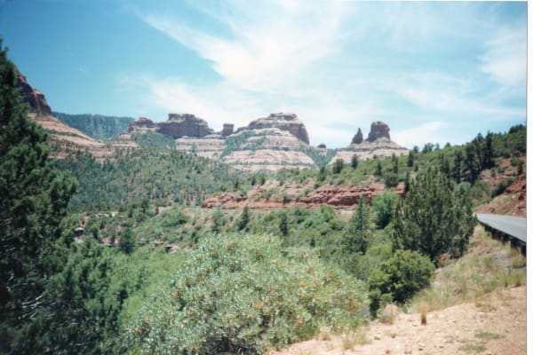
Oak Creek Canyon looking up-canyon on faded colour film — banded buttes of red rock over pale cream closing the head of the canyon, dense ponderosa and juniper covering both walls, and a red ledge running across the middle distance. State Route 89A shows only as a short length of steel guardrail at the right edge, and none of the switchbacks the drive is known for is in the frame. The near foreground is swept into horizontal blur by camera motion while the far canyon stays sharp.

Oak Creek Canyon

Sedona

The switchback drive from red rock to ponderosa on State Route 89A

View details →
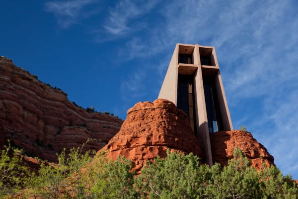
The Chapel of the Holy Cross above Sedona, shot steeply from below — a narrow concrete tower rising between two rounded knobs of red sandstone, its front face formed by a plain cross set between tall glazed slots running the full height of the shaft. Layered red cliffs step back to the left, juniper and scrub fill the foreground, and thin cirrus crosses a deep blue sky. No part of the town of Sedona is in the frame.

Sedona

Sedona

Red-rock skyline, Little Hollywood, and the town Sedona Schnebly gave her name to

View details →

Historic Sites

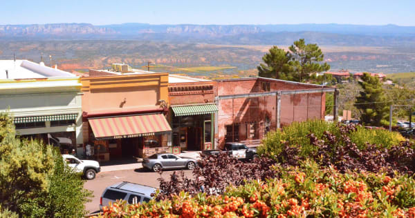
Jerome seen from above its own main street, the town built along a shelf on the side of Cleopatra Hill — a row of storefronts under striped awnings with PAUL & JERRY'S SALOON lettered across one, a roofless brick shell standing gutted and fenced beyond it, and cars parked at the kerb. An orange-berried pyracantha fills the near foreground and a ponderosa stands at the right. Beyond the roofs the ground falls away across the whole Verde Valley to red rock and a long blue escarpment on the horizon. The town is plainly occupied, and no mine workings are in the frame.

Jerome

Cottonwood

The billion-dollar copper camp clinging to Cleopatra Hill — now the largest ghost town in America

View details →
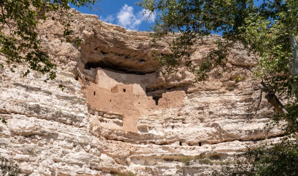
Montezuma Castle from directly below, a block of mud-plastered masonry standing several storeys high in a deep undercut in a pale limestone cliff, its rooms stepped back under the overhang with small dark door and window openings across the front. Bands of eroded limestone run the width of the frame above and below it, sycamore branches hang in at both edges, and a strip of blue sky with small cumulus shows over the rim. It was built by the people archaeologists call Sinagua; the name on the map is not theirs, and no emperor was ever here.

Montezuma Castle

Camp Verde

A five-story Sinagua cliff dwelling, misnamed for an emperor who was never here

View details →
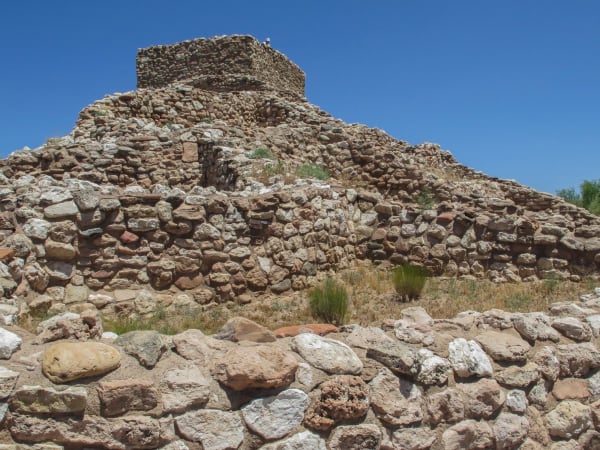
Tuzigoot from the foot of its hill, the pueblo rising in stepped courses of rough pale limestone and sandstone to a two-storey room block on the summit, wall lines running out along the slope on either side. Dry grass, rabbitbrush and bare stone fill the ground between them, a wall of large rounded cobbles crosses the immediate foreground, and a deep blue cloudless sky stands behind. The site was excavated and its walls raised again during the Depression, so part of what stands is reconstruction.

Tuzigoot

Clarkdale

A hilltop Sinagua pueblo over the Verde, dug out of the ground in the Depression

View details →

Towns & Gateways

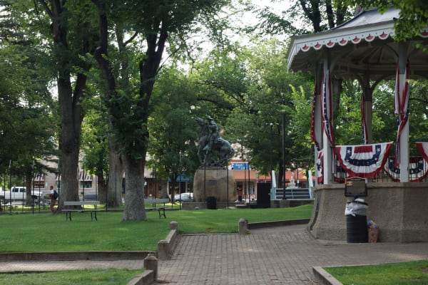
The Yavapai County Courthouse Plaza at Prescott under big shade elms — the Rough Rider Monument at the centre, Solon Borglum's 1907 bronze of a mounted man on a plunging horse set on a rough granite boulder, and the plaza bandstand at the right hung with red, white and blue bunting. Picnic tables and a brick path cross the grass, one walker passes at the left, and storefronts stand across the road behind under striped awnings. The courthouse building itself is out of frame.

Prescott

Prescott

Arizona's first territorial capital — Whiskey Row, the courthouse square, and a mile-high pine town

View details →

Stories from Red Rock Country & the Central Highlands

History

The Names on the Map

Almost every name in the Verde Valley — Montezuma, Prescott, Jerome — was given by or for an outsider who never belonged to the ground, in the years just after the Army marched the valley's actual people to San Carlos. Read the map closely and it becomes a receipt for a theft.

5 min read

Red Rock Country & the Central Highlands rewards the unhurried. Pick a base, fan out, and let the country between the headline stops surprise you.

← Explore more of Open Road Guide