Home / Tennessee / Chattanooga & Southeast Tennessee / Savage Gulf State Park
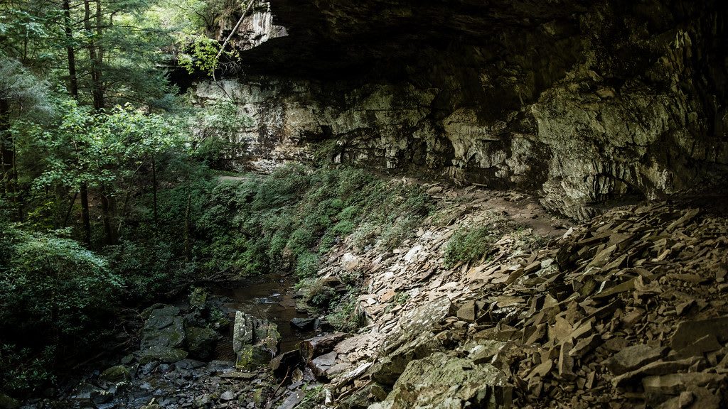
A shaded rock overhang above a small creek in Savage Gulf.Sharon Mollerus / CC BY 2.0 via Flickr
🌲Natural

Savage Gulf State Park

Part ofChattanooga & Southeast Tennessee

Roughly 19,000 acres of gorge and sandstone bluff on the western edge of the Cumberland Plateau, a state park of its own since 2022, with the Stone Door and a National Natural Landmark.

⏱
Duration
Two hours to a weekend.
🎟
Admission
See Tennessee State Parks for current fees.
📅
Best Season
Year round. Spring and fall are best; summer is hot and humid and the trails are long.

The Story

Savage Gulf lies on the western edge of the Cumberland Plateau, where sandstone bluffs drop into gorges that branch from the headwaters of the Collins River. For years it was the largest part of South Cumberland State Park, and in 2022 Tennessee made it a state park of its own. The natural area holds a National Natural Landmark designation, a stand of old-growth hardwoods, and about a third of the nearly 2,300 native plant species identified in the state. The state now gives the park as roughly 19,000 acres.

The Stone Door is the place most visitors head for, a natural crevice that cuts through the bluff and leads toward the gorge. The Stone Door Ranger Station is the trailhead, and a 0.2-mile paved stretch of the Stone Door Trail ends at the Laurel Gulf Overlook, an accessible observation deck. Beyond it the park has about fifty miles of trails, including the Big Creek Trail. The name comes from the Savage family, who once owned part of the land, and from Savage Gulf itself.

The country is rugged and the park warns that jumping from waterfalls is prohibited and that high bluffs need care. Phone maps sometimes misroute visitors, so use the trailhead addresses the park publishes. Lots fill in the morning in busy seasons. The Grundy Lakes tract of neighboring South Cumberland preserves the ruins of coal and coke works and a stockade where convicts were worked.

Visitor Info

⏱
Time Needed
Two hours to a weekend.
🎟
Admission
See Tennessee State Parks for current fees.
📅
Best Season
Year round. Spring and fall are best; summer is hot and humid and the trails are long.
🛣️
Highway
Stone Door Road

On the Map

Nearby

The closest stops worth working into your route

historical22 mi away
Sewanee: The University of the South
The Episcopal university on the Cumberland Plateau, founded in 1857 as a school for the slaveholding South and now examining that history through its own Roberson Project.
natural23 mi away
Fall Creek Falls State Park
A New Deal park on the western edge of the Cumberland Plateau, where Cane Creek has cut a gorge and a 256-foot waterfall drops into it.
natural25 mi away
Rock Island State Park
A park where the Collins, Rocky and Caney Fork rivers meet at the head of Center Hill Lake, with a gorge of waterfalls below a 1917 dam and the remains of a cotton-mill town.
historical25 mi away
Old Stone Fort State Archaeological Park
A 2,000-year-old enclosure of piled stone and earth on the bluffs above the forks of the Duck River, built by Native people between about 80 and 550 A.D., with a museum and waterfall trails.
historical33 mi away
Ross's Landing
The Tennessee River landing where Chattanooga began and where Muscogee (Creek) and Cherokee people were put on boats and ferried out in 1837 and 1838.
historical33 mi away
Walnut Street Bridge
An 1890 truss bridge now open to walkers, and the place where Alfred Blount in 1893 and Ed Johnson in 1906 were lynched, the case that led to the Supreme Court's only criminal trial.

Historical markers nearby

Roadside plaques and monuments within a short detour

Marker14 mi away
Higgenbotham's Cave
McMinnville
Marker14 mi away
Camp Forrest/Forrest Camp Spencer Artillery Range -ca. 1941-1946-
Spencer
Marker14 mi away
Trail Of Tears circa 1838
Spencer
Marker17 mi away
Bernard School
McMinnville
Marker17 mi away
Carl T. Rowan
McMinnville
Marker17 mi away
Anthia Brady Hughes 1868-1949 Willie Huges 1895-1986
McMinnville