Home / Kentucky / Red River Gorge & the Eastern Hills / Red River Gorge Geological Area
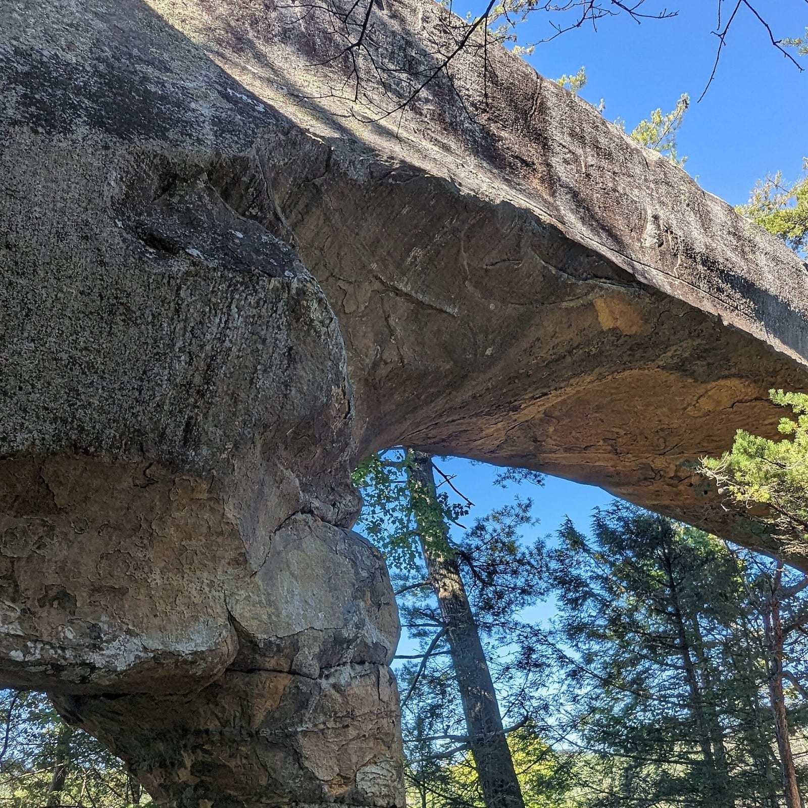
The underside of Sky Bridge, a sandstone arch in the Red River Gorge, framed against blue sky and pines.Mtn-graphic / CC BY-SA 4.0 via Wikimedia Commons
🏜️Geological

Red River Gorge Geological Area

Part ofRed River Gorge & the Eastern Hills
On this driveRed River Gorge Scenic Byway: Stanton, Nada Tunnel and Natural Bridge

The Daniel Boone National Forest's canyon country: sandstone cliffs, rock shelters and more than 100 arches, with the Gladie Visitor Center on KY 715.

⏱
Duration
A full day for a loop of arches and overlooks; most visitors stay a weekend.
🎟
Admission
The Gladie Visitor Center is free; overnight parking in the gorge needs a Forest Service recreation pass (USFS, 2026).
📅
Best Season
April for wildflowers and October for color; summer and fall weekends are crowded.

The Story

The Red River has cut its gorge into the Pottsville Escarpment, the sandstone edge of the Cumberland Plateau, and left a country of high cliffs, rock shelters, waterfalls and more than 100 natural arches, possibly the largest cluster east of the Rocky Mountains. About 29,000 acres of the Daniel Boone National Forest are set aside as the geological area, a National Natural Landmark, with the Clifty Wilderness inside it. The Gladie Visitor Center on KY 715 keeps a historic two-story cabin and barn.

People have used these shelters for more than 11,000 years. The dry, nitrate-rich soil under the overhangs kept what rots elsewhere: woven slippers, nut bags, wooden tools and the remains of about fifty kinds of plants. Those seeds are some of the earliest evidence of farming in eastern North America. In the Late Archaic and Early Woodland periods people here grew goosefoot, marsh elder, maygrass, little barley, sunflower and squash, part of an independent center of plant domestication now called the Eastern Agricultural Complex. In 2003 the gorge, Clifty and the Indian Creek area were listed together as a National Register archaeological district of 37,217 acres. Looting has damaged many sites, and camping in rock shelters is not allowed.

Logging came in a boom in the 1880s. Beginning in 1910 the Dana Lumber Company blasted a 900-foot tunnel through a sandstone ridge so narrow-gauge trains could haul logs to a sawmill at Clay City; one worker died when dynamite he was thawing by a fire exploded. Nada Tunnel still carries KY 77 into the gorge, one lane and unlit.

Visitor Info

⏱
Time Needed
A full day for a loop of arches and overlooks; most visitors stay a weekend.
🎟
Admission
The Gladie Visitor Center is free; overnight parking in the gorge needs a Forest Service recreation pass (USFS, 2026).
📅
Best Season
April for wildflowers and October for color; summer and fall weekends are crowded.
🛣️
Highway
KY 715

On the Map

Nearby

The closest stops worth working into your route

natural2.9 mi away
Red Wild and Scenic River
The stretch of the Red River that a 1960s Corps of Engineers dam would have flooded, saved by a 1967 protest hike, a book and a 1993 act of Congress.
geological5.6 mi away
Natural Bridge State Resort Park
A 78-foot sandstone arch that a railroad opened to tourists in 1895, one of Kentucky's four original state parks, with Hemlock Lodge below it.
industrial18 mi away
Cottage Furnace
A cut-stone charcoal iron furnace of the 1850s in the Daniel Boone National Forest, from the years when Kentucky was a leading iron state.
recreational19 mi away
Cave Run Lake
An 8,270-acre Corps of Engineers lake on the Licking River south of Morehead, finished in 1973 and nearly all inside the Daniel Boone National Forest.
historical19 mi away
Pilot Knob State Nature Preserve
The sandstone knob west of Stanton where tradition puts Daniel Boone's first look at the Bluegrass on June 7, 1769, with an old millstone quarry below.
cultural26 mi away
Kentucky Folk Art Center
Morehead State University's folk art museum in the old Union Grocery on First Street, with about 1,400 works by Kentucky self-taught artists.

Historical markers nearby

Roadside plaques and monuments within a short detour

Marker7.6 mi away
USA Gens. Morgan CSA
Campton
Marker7.6 mi away
Wolfe County, 1860
Campton
Marker8.1 mi away
Meniffe County
Frenchburg
Marker11 mi away
USA Gens. Morgan CSA
Hazel Green
Marker14 mi away
County Named, 1852
Stanton
Marker17 mi away
Early Iron Works
Clay City