Home / Kentucky / Cumberland Gap & the Coalfields / Pine Mountain State Resort Park
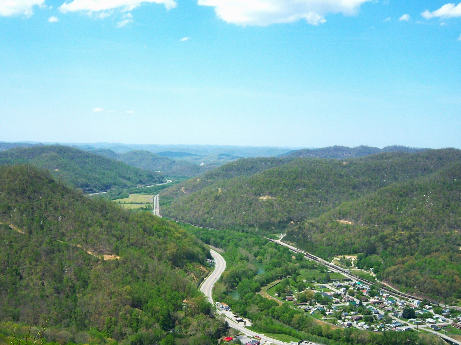
From an overlook in Pine Mountain State Resort Park, wooded ridges fall away to Pineville and the highway in the valley below.J654567 / CC BY-SA 3.0 via Wikimedia Commons
🏕️Recreational

Pine Mountain State Resort Park

Part ofCumberland Gap & the Coalfields

Kentucky's oldest state park, on the ridge above Pineville, with CCC stonework, the Laurel Cove amphitheater and the chained boulder over town.

⏱
Duration
Two hours to a full day.
🎟
Admission
Free to enter; lodge, cottages and golf are fee-based.
📅
Best Season
Late spring for the mountain laurel; fall for color.

The Story

Pine Mountain rises straight up behind Pineville, and the park on its crest is the oldest in the Kentucky system. Bell County people put together a 2,000-acre tract and offered it to the state for recreation and conservation. In 1924 Pineville residents pledged the land, including an old deer farm on the mountain, and the State Park Commission accepted it. It opened as Cumberland State Park and was renamed to keep it from being confused with Cumberland Falls.

The look of the place comes from the Civilian Conservation Corps, which went to work here in 1933 and built the main office, cabins, roads, bridges, shelters and the hiking trails. The Laurel Cove Amphitheater has crowned the queen of the Kentucky Mountain Laurel Festival each spring since the early 1930s, and it holds a music festival in June. The Herndon J. Evans Lodge has 30 rooms and a restaurant, and the state added a lodge wing, cottages and a pool in the 1960s; the golf course is Wasioto Winds.

The park's best-known sight is a joke that stuck. In 1933 a group from Pineville hauled a 101-foot chain up the mountain and fastened it to a huge boulder above town, saying it would keep the rock from rolling down onto the city. Chained Rock is still up there, chain and all, looking down on Pineville and the Cumberland River.

Visitor Info

⏱
Time Needed
Two hours to a full day.
🎟
Admission
Free to enter; lodge, cottages and golf are fee-based.
📅
Best Season
Late spring for the mountain laurel; fall for color.
🛣️
Highway
US-25E

On the Map

Nearby

The closest stops worth working into your route

historical9.5 mi away
Cumberland Gap National Historical Park
The Kentucky door to the gap: a visitor center outside Middlesboro, the Pinnacle Overlook, Gap Cave and the Hensley Settlement on Brush Mountain.
historical10 mi away
Cumberland Gap, Tennessee, and the Wilderness Road
The Claiborne County town below the notch in Cumberland Mountain where Daniel Boone's axmen widened the Warriors' Path into the Wilderness Road in 1775, now bypassed by a tunnel.
historical12 mi away
Dr. Thomas Walker State Historic Site
A small state site south of Barbourville with a replica of the cabin Thomas Walker's party built in 1750, the first house built by settlers in what became Kentucky.
culinary25 mi away
Harland Sanders Cafe and Museum
The 1940 roadside cafe and motel on old US-25 in North Corbin where Harland Sanders worked out his fried chicken, now a museum with a working KFC attached.
historical30 mi away
Levi Jackson Wilderness Road Park
A park south of London where walkable stretches of Boone's Trace and the Wilderness Road meet the 1786 McNitt Defeat burial ground, a pioneer museum and McHargue's Mill.
cultural33 mi away
Vardy Community Museum
A 1899 Presbyterian church in Hancock County, now a museum, beside the Mahala Mullins cabin and the ruins of the Vardy school that educated the Melungeon children of Newman's Ridge.

Historical markers nearby

Roadside plaques and monuments within a short detour

Marker2.7 mi away
Wallsend Mine
Pineville
Marker3 mi away
Joshua Fry Bell
Pineville
Marker3.1 mi away
Cumberland Ford
Pineville
Marker8.9 mi away
Middlesboro Meteorite Crater Impact Site
Middlesboro
Marker8.9 mi away
Colonel Arthur Campbell
Middlesboro
Marker8.9 mi away
Greg Page
Middlesboro