Home / Tennessee / The Tri-Cities & Northeast Tennessee / Cumberland Gap, Tennessee, and the Wilderness Road
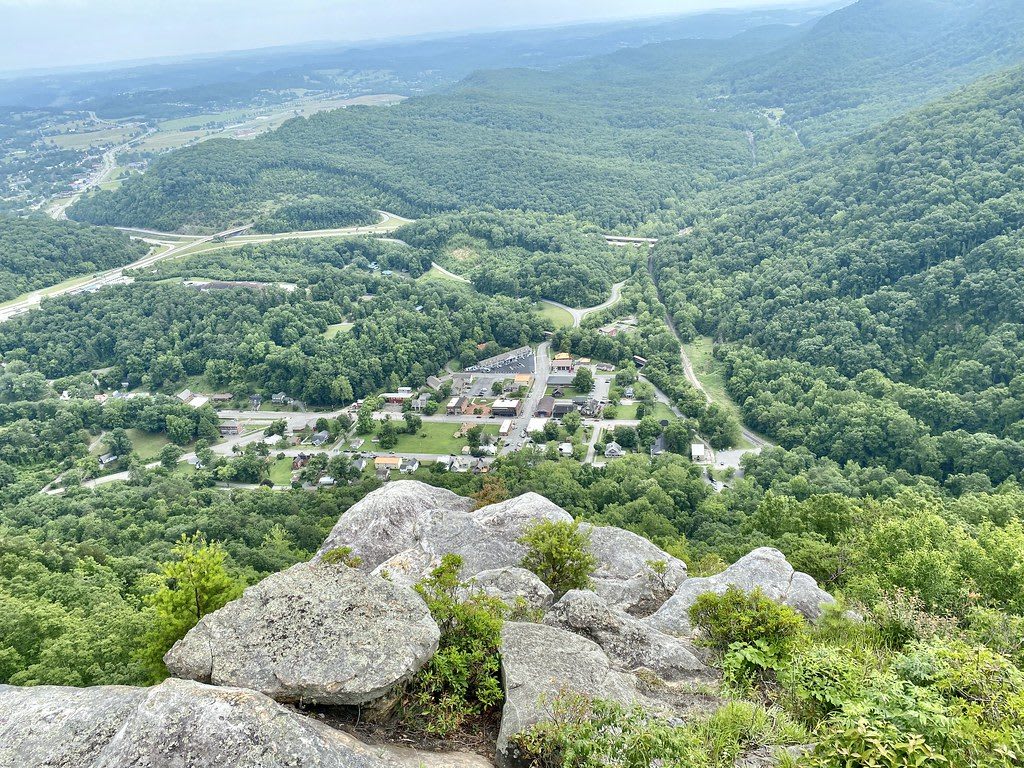
A rocky overlook high above the small town of Cumberland Gap, Tennessee, with a highway and forested ridges beyond.Warren LeMay / CC BY-SA 2.0 via Flickr
🏛️Historical

Cumberland Gap, Tennessee, and the Wilderness Road

Part ofThe Tri-Cities & Northeast Tennessee

The Claiborne County town below the notch in Cumberland Mountain where Daniel Boone's axmen widened the Warriors' Path into the Wilderness Road in 1775, now bypassed by a tunnel.

⏱
Duration
One to two hours in town; longer with the national park.
🎟
Admission
Free to walk the town; see the National Park Service for the national historical park.
📅
Best Season
Year round.

The Story

The gap is a notch in Cumberland Mountain where Tennessee, Kentucky and Virginia meet, and the people who used it first were Native. Cherokee and Shawnee travelers followed a game trail through it that settlers called the Warriors' Path, across hunting ground claimed by the Shawnee to the north and the Cherokee to the south. Thomas Walker brought the pass to settlers' notice in 1750 and named it for the Duke of Cumberland.

In 1775 Daniel Boone, hired by the Transylvania Company that had just bought Cherokee land at Sycamore Shoals, led axmen from Long Island of the Holston through the gap and widened the trail into the Wilderness Road. Before 1810 an estimated 200,000 to 300,000 settlers passed this way into Kentucky and the Ohio Valley. The road was dangerous. In the fall of 1784 Chickamauga warriors under Dragging Canoe ambushed travelers between the gap and Crab Orchard, killing more than 100 people. In the Civil War the gap changed hands four times.

The Tennessee town below it, Cumberland Gap, has about 300 residents, and most of its downtown is a National Register historic district. Alexander Arthur built a railroad tunnel here in 1888. Twin tunnels opened in 1996 and carry US-25E under the mountain, which took through traffic off the town's streets. The national historical park is run from Middlesboro, Kentucky, and has fortifications and walking trails above the town.

Visitor Info

⏱
Time Needed
One to two hours in town; longer with the national park.
🎟
Admission
Free to walk the town; see the National Park Service for the national historical park.
📅
Best Season
Year round.
🛣️
Highway
US-25E

On the Map

Nearby

The closest stops worth working into your route

cultural27 mi away
Vardy Community Museum
A 1899 Presbyterian church in Hancock County, now a museum, beside the Mahala Mullins cabin and the ruins of the Vardy school that educated the Melungeon children of Newman's Ridge.
industrial35 mi away
Norris Dam and Norris Dam State Park
TVA's first dam, finished in 1936 on the Clinch River, and the state park beside it with the 1798 Rice Grist Mill, built for a valley whose families were moved out.
cultural36 mi away
Museum of Appalachia
John Rice Irwin's 65-acre collection of moved log cabins and mountain objects north of Knoxville, opened in 1969, with a cabin believed to be Mark Twain's father's.
historical39 mi away
Rogersville Historic District
Tennessee's first newspaper was printed in this Hawkins County seat in 1791, and Swift Memorial College, founded in 1883, educated Black students after the state's 1901 law forced Maryville College to expel them.
cultural43 mi away
Green McAdoo Cultural Center
The 1935 school in Clinton that sent twelve Black students down Foley Hill to desegregate Clinton High School in August 1956, now a museum with bronze statues of the Clinton 12.
cultural45 mi away
Beck Cultural Exchange Center
Knoxville's Black history museum and archive, opened in 1975 in the 1912 Dandridge Avenue house the community bought for $22,500.