Home / Kansas / Monument Rocks & the High Plains / Monument Rocks
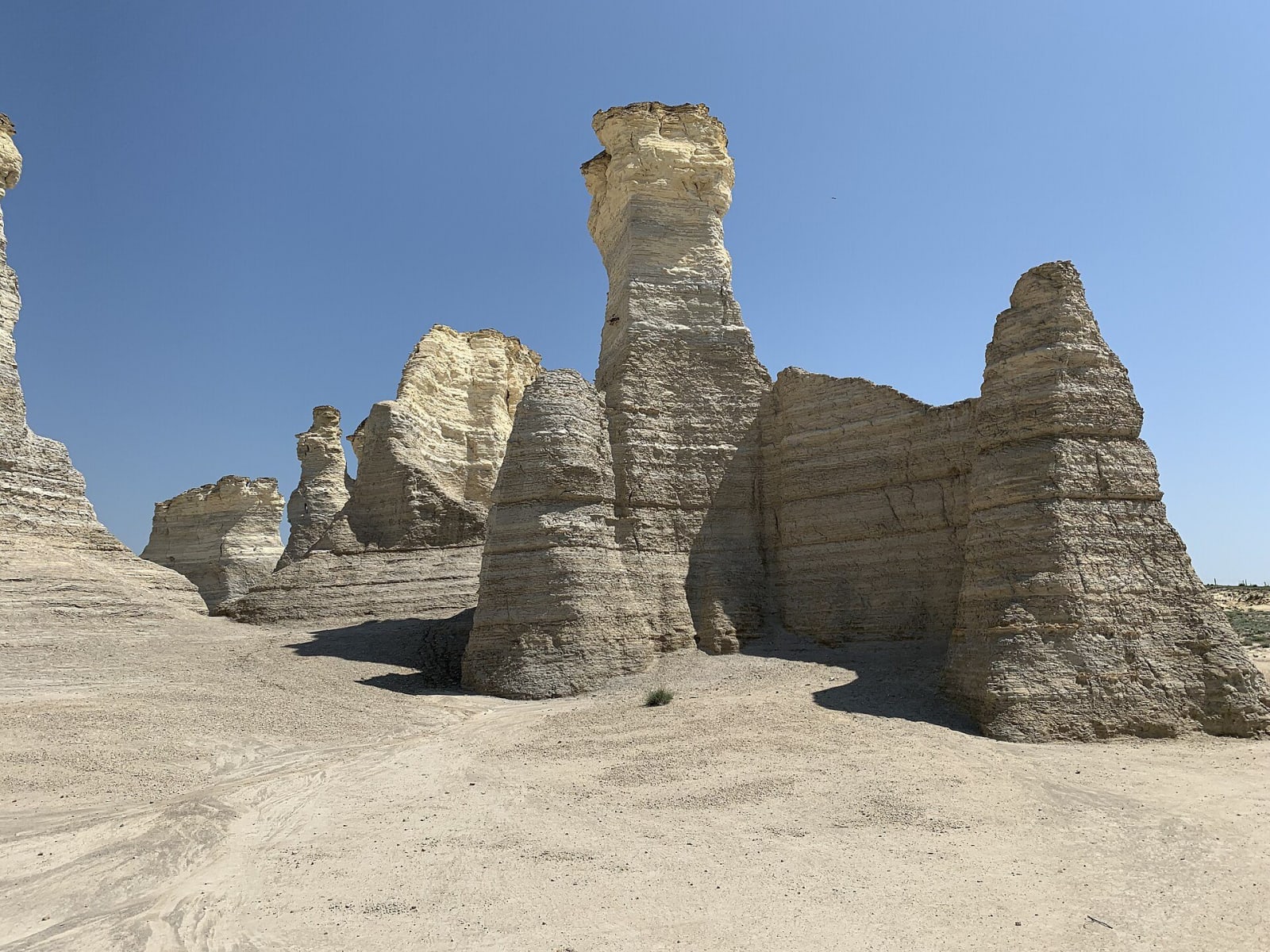
Tall weathered chalk spires of Monument Rocks standing on pale bare ground.Hu Nhu / CC BY-SA 4.0 via Wikimedia Commons
๐Ÿœ๏ธGeological

Monument Rocks

Part ofMonument Rocks & the High Plains
On this driveUS-83: The Chalk Badlands, Oakley to Scott City

Chalk towers and an arch from the floor of an inland sea, standing beside a county road in Gove County pasture, still losing pieces to weather and still full of nesting cliff swallows.

โฑ
Duration
Thirty minutes to an hour.
๐ŸŽŸ
Admission
Free; private land open by the owners' courtesy.
๐Ÿ“…
Best Season
Any season in dry weather; the county roads can become impassable when wet.

The Story

These pillars are the Smoky Hill Chalk, an ooze of microscopic shells that settled on the floor of an inland sea about 80 million years ago at roughly a third of a millimeter every ten years, and built up hundreds of feet. Most of the chalk later wore away. These blocks survived because harder, cemented beds on top shielded the softer layers below. In their sides you can see thin gray seams of gypsum and the shells of the oyster Ostrea congesta, and cliff swallows plaster mud nests on the walls.

The rocks are not finished changing. A spire called the Sphinx, or Old Chief Smoky, that showed a human face from the side fell in 1986. The Keyhole Arch grows wider every year, and local lore says it began when someone shot a bullet through a thin spot. Travellers on the Butterfield Overland Despatch used the formations as a landmark, and a Fort Monument stood nearby to guard that road. On October 31, 1968, the site became the first National Natural Landmark in Kansas.

The rocks stand on private ranch land, and the owners let visitors drive the county road between them and walk around them. The rules are posted and enforced: no climbing, since the chalk breaks, no digging for fossils, no fires, and no wandering into the surrounding pasture. There are no restrooms, fuel or food nearby, and the roads turn to mud after rain. Keystone Gallery on U.S. 83 hands out maps.

Visitor Info

โฑ
Time Needed
Thirty minutes to an hour.
๐ŸŽŸ
Admission
Free; private land open by the owners' courtesy.
๐Ÿ“…
Best Season
Any season in dry weather; the county roads can become impassable when wet.
๐Ÿ›ฃ๏ธ
Highway
US-83

On the Map

Stories

A story featuring this place

Go deeper into the history and character of this stop

Geology
Birds with Teeth
Open Road Guide ยท 3 min read

Nearby

The closest stops worth working into your route

cultural6.7 mi away
Keystone Gallery
A homesteaders' stone church of 1917 on US-83 above the Smoky Hill valley, rebuilt off the power grid as a fossil museum by a family that has hunted the chalk since 1925.
geological9.4 mi away
Little Jerusalem Badlands State Park
A maze of Niobrara chalk walls above the Smoky Hill River, once ranch land, now held by The Nature Conservancy for raptors and a buckwheat that grows nowhere else.
natural12 mi away
Historic Lake Scott State Park
A spring-fed lake in a hidden canyon off U.S. 83, where water seeping out between gravel and chalk drew Apache and Pueblo farmers, a homesteading couple, and finally the state.
historical45 mi away
Fort Wallace Museum
A museum complex on US-40 in Wallace gathered from across the county: the 1865 Pond Creek stage station, the Weskan depot and a Swedish colony's 1888 church.
attraction58 mi away
Lee Richardson Zoo
Garden City's zoo in Finnup Park, begun in 1927 with two skunks and now accredited, free to walk in and open to cars on a drive-through loop for a vehicle fee.
natural59 mi away
Sandsage Bison Range and Wildlife Area
The 3,760-acre remnant of the Kansas National Forest south of Garden City, where federal tree planting failed and the state's oldest publicly owned bison herd now grazes sand sage prairie.

Historical markers nearby

Roadside plaques and monuments within a short detour

Marker12 mi away
El Cuartelejo
Marker14 mi away
El Cuartelejo