Home / Nebraska / The Republican Valley & the Southwest / Harlan County Lake
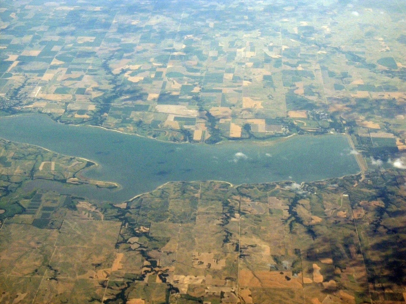
Harlan County Lake seen from an airplane, a long reservoir among farm fields and branching draws.Ken Lund / CC BY-SA 2.0 via Wikimedia Commons
🏕️Recreational

Harlan County Lake

Part ofThe Republican Valley & the Southwest

Nebraska's second-largest lake, held behind an Army Corps dam on the Republican between Alma and Republican City, built after the flood of 1935 ran bluff to bluff.

⏱
Duration
Half a day to several days.
🎟
Admission
Camping fees apply; the Corps lists site prices with its reservations.
📅
Best Season
May through September for camping and boating; winter for ice fishing.

The Story

On May 31, 1935, a storm dropped as much as 24 inches of rain on the Republican's watershed, and the river came down the valley running bluff to bluff. The National Weather Service lists it as the worst flood in Nebraska's history. It killed more than ninety people, did more than $26 million in damage and wiped out Republican City. The answer, in time, was a dam. The Army Corps of Engineers built Harlan County Dam across the valley for flood control and irrigation, and Republican City was rebuilt in 1952 about two miles north, on the higher ground above the new lake.

At normal pool the lake covers about 13,250 acres with some 75 miles of shoreline, the second largest body of water in the state. Full, it can hold more than 840,000 acre-feet, and more than half of that is reserved for flood control. Below the dam, Nebraska, Kansas and Colorado divide the river's water under the Republican River Compact, and the Corps works with Kansas on releases.

The Corps runs the lake and the land around it. The Hunter Cove and Methodist Cove campgrounds are open May through September, Gremlin Cove and the North and South Outlet areas mid-May to mid-September, and Cedar Point is day use only. People come for walleye, white bass, wipers, catfish and crappie, for ice fishing in winter and for hunting in the river bottoms. In dry summers low water has closed boat ramps, and the Corps posts closures on its lake page.

Visitor Info

⏱
Time Needed
Half a day to several days.
🎟
Admission
Camping fees apply; the Corps lists site prices with its reservations.
📅
Best Season
May through September for camping and boating; winter for ice fishing.
🛣️
Highway
US-136

On the Map

Nearby

The closest stops worth working into your route

natural37 mi away
Willa Cather Memorial Prairie
Six hundred and twelve acres of never-plowed mixed-grass prairie south of Red Cloud, once Kitkehahki Pawnee country, named for the writer who said the grass was the country.
cultural37 mi away
National Willa Cather Center
The restored Moon Block on Red Cloud's Webster Street, home of the Willa Cather Foundation, with the town she grew up in and wrote about laid out around it.
historical43 mi away
Fort Kearny State Historical Park
The 1848 army post on the Platte, built on a strip of Pawnee land bought for $2,000 in goods, where emigrant wagons passed by the thousand and only the cottonwoods outlasted the fort.
natural46 mi away
Rowe Sanctuary
Audubon's sanctuary on the Platte near Gibbon, where the river's sandbars are kept bare so that sandhill cranes, more than a million in the valley each spring, can roost safely at night.
cultural73 mi away
Stuhr Museum of the Prairie Pioneer
Edward Durell Stone's island pavilion in Grand Island and an 1890s railroad town of moved buildings, among them the cottage where Henry Fonda was born in 1905.
historical75 mi away
Senator George Norris State Historic Site
The McCook house George W. Norris kept as his home base for forty-two years, given to the state with its furniture by his wife Ellie, by the senator who wrote the lame-duck amendment.