Home / South Dakota / Sioux Falls & the Southeast / Falls Park
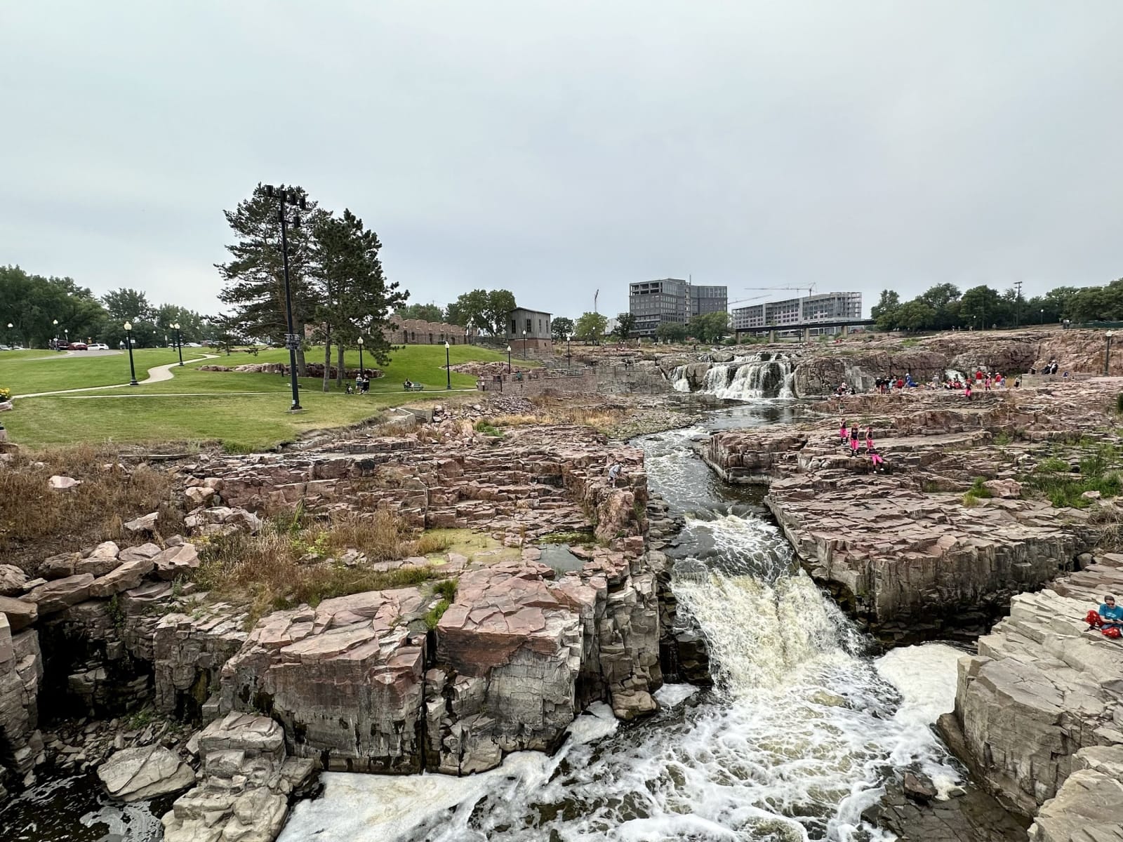
The Big Sioux River pouring through channels in blocky pink quartzite at Falls ParkRichard N Horne / CC BY-SA 4.0 via Wikimedia Commons
🏛️Historical

Falls Park

Part ofSioux Falls & the Southeast
On this driveI-90: Sioux Falls to the Badlands

The falls a town company came for in 1856, abandoned in 1862, and tried to make pay with a seven-story quartzite mill that ran for barely two years.

Year-RoundPioneer HistorySpringFree
⏱
Duration
One to two hours.
🎟
Admission
Free.
📅
Best Season
Spring for high water; year-round, with lights in winter.

The Story

Town promoters from Dubuque, Iowa, reached the falls of the Big Sioux in 1856, drawn by a book that praised their beauty and their water power, and a rival company from St. Paul arrived the next spring and named the place Sioux Falls. It stayed a handful of claim cabins. In August 1862, as war broke out between the Dakota and settlers in Minnesota, the settlers fled, and the empty town was looted and burned. Soldiers and settlers came back in the 1860s, and by the 1880s the railroad had made it a city.

The falls were still supposed to make it rich. Richard Pettigrew, the town's most ambitious promoter and later one of the state's first senators, persuaded the New York investor George Seney to finance a flour mill at the head of the falls, and the Queen Bee Mill, seven stories of pink quartzite cut on the spot, opened on October 25, 1881. It was among the most modern mills in the region, and it failed within two years: the river ran too low too much of the year, and the farms around could not supply enough wheat. A story that Pettigrew had fooled Seney about the water has followed it ever since. The empty mill burned in 1956, and the city knocked down its upper walls; the stump of the lower stories still stands beside the falls.

The Sioux Falls Light and Power Company reused the mill's dam and millrace for a hydroelectric plant built in 1908, which ran until 1974 and now holds a cafe. An observation tower looks down on the falls, and the water is highest and loudest in spring.

Visitor Info

⏱
Time Needed
One to two hours.
🎟
Admission
Free.
📅
Best Season
Spring for high water; year-round, with lights in winter.
🛣️
Highway
I-229

On the Map

Nearby

The closest stops worth working into your route

historical49 mi away
Spirit Mound Historic Prairie
A lone hill north of Vermillion that Lewis and Clark walked to on a scorching day in 1804, now one of the few places left where you can stand exactly where they stood.
cultural55 mi away
National Music Museum
One of the great collections of musical instruments in the world, on a college campus in a prairie town, built around a band teacher's thousands of horns, fiddles and curiosities.
architectural66 mi away
Corn Palace
The last survivor of more than thirty corn palaces built across the Midwest, a basketball arena with domes by a Chicago theater firm, covered every year in new murals of corn.
historical67 mi away
Mitchell Prehistoric Indian Village
A fortified farming village of about seventy earth lodges above Firesteel Creek a thousand years ago, ancestral to the Mandan, still being excavated under a dome.
historical69 mi away
Ingalls Homestead and the De Smet Historic Homes
The quarter section a mile from De Smet that Charles Ingalls filed on in 1880 and proved up in 1886, the house in town he built, and the cottonwoods he planted.
historical103 mi away
Fort Randall
The ruined stone chapel of an 1856 Missouri River post below Fort Randall Dam, where Sitting Bull and his band were held as prisoners for two years.