Home / Georgia / Rome, Chickamauga & Northwest Georgia / Etowah Indian Mounds State Historic Site
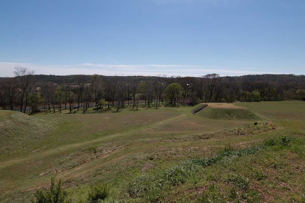
A wide grassy plain with a low flat-topped earthen mound in the distance, under a pale blue sky with a tree line beyond.StephenGA / CC0 via Flickr
🏛️Historical

Etowah Indian Mounds State Historic Site

Part ofRome, Chickamauga & Northwest Georgia

Italwa, the Mississippian town on the Etowah River that the Muscogee (Creek) Nation counts as its most important ancestral town, with a 63-foot platform mound.

⏱
Duration
One and a half to two hours.
🎟
Admission
Adults $6, seniors 62 and older $4.50, youth 6-17 $4, children under 6 $2, plus tax (Georgia State Parks, 2026).
📅
Best Season
Year round. Open daily 9 a.m. to 5 p.m., the mounds area closing at 4:30 p.m.; closed Thanksgiving, Christmas and New Year's Day (Georgia State Parks, 2026). Spring and fall are kindest for the open grounds.

The Story

The Muscogee (Creek) Nation and the Poarch Band of Creek Indians hold this town as their most important ancestral town, and its name comes from the Muscogee word italwa, meaning town. From about 1000 to 1550 several thousand people lived here on the north bank of the Etowah River. On 54 acres they raised six earthen mounds around two plazas, ringed the town with a palisade and a deep ditch, and farmed corn, beans and squash on soil the floods renewed each year. The largest mound, 63 feet high, likely carried the house of the town's priest-chief. Later settlers long credited the mounds to the Cherokee, who reached this country only centuries after they were built.

One smaller mound was a burial place for the town's leaders, laid to rest in elaborate dress with copper plates, shell ornaments and pairs of carved marble figures, a seated man and a kneeling woman, thought to stand for ancestors. Excavators dug into that mound from the 1920s on, and what they found helped define the Southeastern Ceremonial Complex, the shared art and belief of the Mississippian world. In 2022 Georgia began returning funerary objects from the site to the Muscogee (Creek) Nation under federal repatriation law. Walk the grounds as you would a cemetery.

The museum holds pottery, stone axes and copper work and shows a short film. A nature trail follows the river to a V-shaped stone fish weir of the kind the townspeople built to trap catfish and gar. The site lies about three miles south of Cartersville.

Visitor Info

⏱
Time Needed
One and a half to two hours.
🎟
Admission
Adults $6, seniors 62 and older $4.50, youth 6-17 $4, children under 6 $2, plus tax (Georgia State Parks, 2026).
📅
Best Season
Year round. Open daily 9 a.m. to 5 p.m., the mounds area closing at 4:30 p.m.; closed Thanksgiving, Christmas and New Year's Day (Georgia State Parks, 2026). Spring and fall are kindest for the open grounds.
🛣️
Highway
Indian Mounds Road

On the Map

Nearby

The closest stops worth working into your route

historical11 mi away
Pickett's Mill Battlefield State Historic Site
One of the best preserved Civil War battlefields in the country, where an unsupported Union brigade was cut down in a ravine on May 27, 1864.
historical16 mi away
Kennesaw Mountain National Battlefield Park
The Cobb County ridge where Sherman's frontal assault failed on June 27, 1864, on land taken from the Cherokee Nation three decades earlier.
cultural20 mi away
Funk Heritage Center
Georgia's official Southeastern Indian interpretive center at Reinhardt University in Waleska, a certified Trail of Tears site in the old Cherokee Nation.
historical23 mi away
Chieftains Museum / Major Ridge Home
The Oostanaula River home of the Cherokee leader Major Ridge, who signed the Treaty of New Echota and was killed for it in 1839.
historical24 mi away
Berry College and Oak Hill
Martha Berry's work school for mountain children, grown since 1902 into a college on more than 27,000 acres north of Rome, with her Oak Hill home and museum.
historical28 mi away
Sweetwater Creek State Park
The burned five-story New Manchester mill on Sweetwater Creek, whose mostly women workers Union troops charged with treason and shipped north in 1864.

Historical markers nearby

Roadside plaques and monuments within a short detour

Marker2.3 mi away
Amos T. Akerman (1821-1880)
Cartersville
Marker2.4 mi away
Site of Sam Jones' Tabernacle
Cartersville
Marker2.7 mi away
Friendship Monument
Cartersville
Marker2.7 mi away
Bartow County
Cartersville
Marker4.9 mi away
Mark Anthony Cooper's Iron Works
Cartersville
Marker5.1 mi away
Battle of Allatoona
Cartersville