Home / Kansas / Monument Rocks & the High Plains / Arikaree Breaks
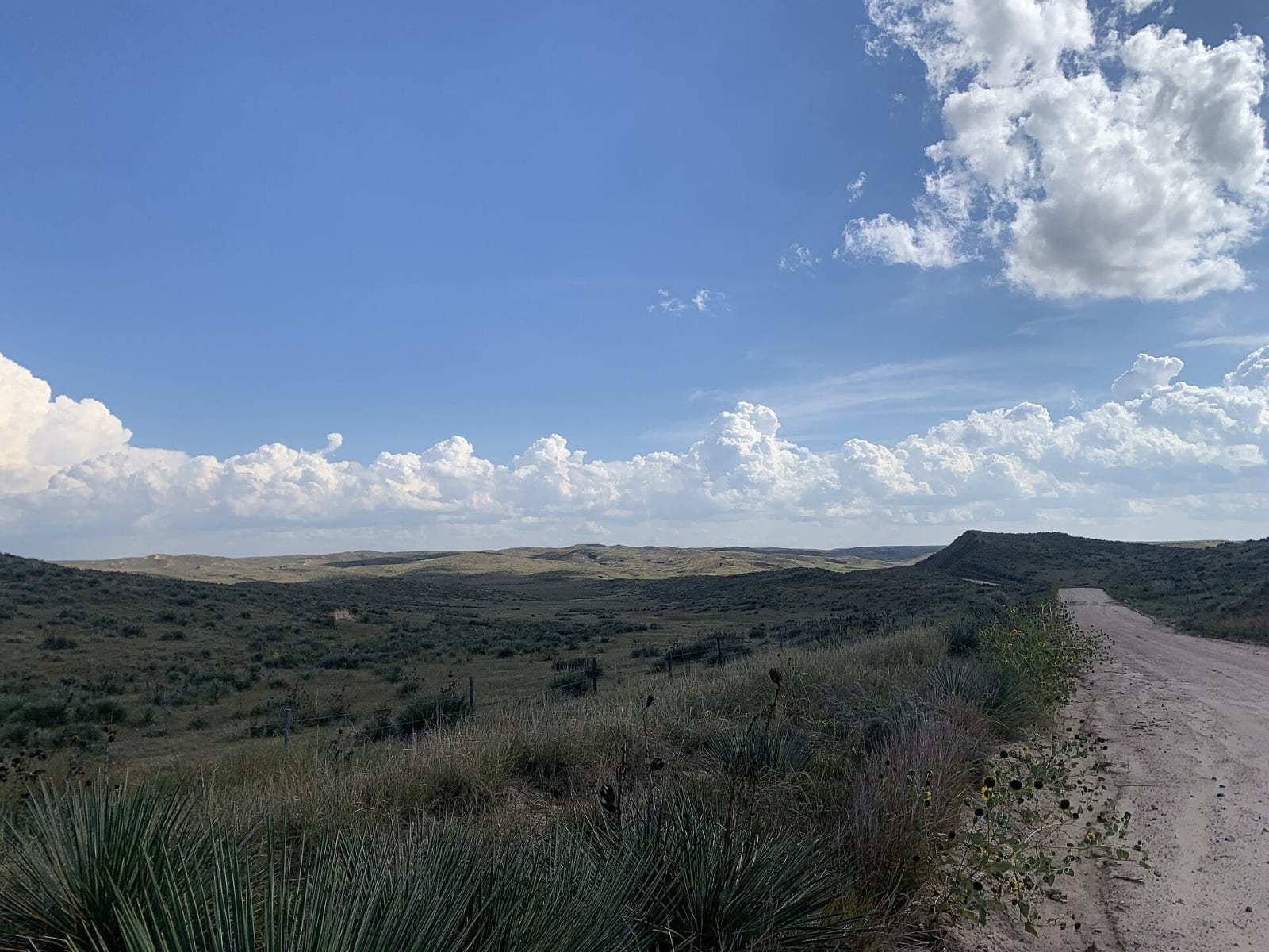
Yucca-dotted ridges and canyons of the Arikaree Breaks fall away beside a dirt road under a cloud-flecked sky.SamuelNelsonGISP / CC0 via Wikimedia Commons
🌲Natural

Arikaree Breaks

Part ofMonument Rocks & the High Plains

A strip of loess canyons two or three miles wide cut across the northwest corner of Kansas, followed by a signed gravel tour north of St. Francis into Nebraska and back.

⏱
Duration
Two to three hours for the loop.
🎟
Admission
Free; public county roads through private land.
📅
Best Season
Spring through fall in dry weather.

The Story

North of St. Francis the plain breaks into ravines and canyons. The Arikaree Breaks are two to three miles wide and, by the county's measure, about 36 miles long, running diagonally across northern Cheyenne County into Rawlins County, and over the lines into Colorado and Nebraska. Thousands of years ago, when the climate here was much wetter, streams cut them into a deposit of wind-blown silt called loess, up to a hundred feet thick.

Loess behaves strangely. Running water carves it easily, yet the canyon walls stand nearly vertical and have held for thousands of years, because its angular grains pack tight enough to cling together. In the deepest canyons the streams have cut through the pale loess into the Ogallala gravels beneath and into the Cretaceous Pierre Shale below that. The creeks run only now and then, draining to the Arikaree River and the North Fork of the Republican, and the slopes grow yucca, sage and prickly pear.

The city of St. Francis lays out a self-guided driving tour. Head north from the corner of Benton and Washington, cross the Republican River, bear right at the first fork, and follow the numbered red-disk signs north on Road 15, unpaved, into Nebraska; then go west on U.S. 34 to Haigler and south on K-27. One of the best views is about 14 miles north of town. Copies of the tour are at the kiosk at the U.S. 36 rest area. The land is private: keep to the public roads, and off them when wet.

Visitor Info

⏱
Time Needed
Two to three hours for the loop.
🎟
Admission
Free; public county roads through private land.
📅
Best Season
Spring through fall in dry weather.
🛣️
Highway
US-36

On the Map

Nearby

The closest stops worth working into your route

historical22 mi away
Beecher Island Battleground
A battlefield whose island is gone: the veterans' memorial of 1905 washed away in the flood of 1935, its pieces reset on the riverbank, the reunion still held every September.
industrial35 mi away
Champion Mill
A water-powered flour and feed mill on Frenchman Creek, running on creek water since 1888 and rebuilt after an 1891 fire, beside a creek that irrigation wells have drawn down.
historical46 mi away
Massacre Canyon Monument
A granite shaft east of Trenton above the canyon where Lakota warriors attacked a Pawnee buffalo-hunting camp on August 5, 1873, a year before the Pawnee left Nebraska.
historical63 mi away
Senator George Norris State Historic Site
The McCook house George W. Norris kept as his home base for forty-two years, given to the state with its furniture by his wife Ellie, by the senator who wrote the lame-duck amendment.
roadside67 mi away
Mount Sunflower
The highest ground in Kansas, 4,039 feet on the Harold family's ranch half a mile from Colorado, with a sunflower of railroad spikes, a mailbox register and an invitation to stop by the house.
historical74 mi away
Fort Wallace Museum
A museum complex on US-40 in Wallace gathered from across the county: the 1865 Pond Creek stage station, the Weskan depot and a Swedish colony's 1888 church.

Historical markers nearby

Roadside plaques and monuments within a short detour

Marker5.2 mi away
Texas Trail Canyon
Nebraska
Marker14 mi away
General Custer in Nebraska
Nebraska
Marker14 mi away
Ward Bond's Boyhood Home
Nebraska
Marker16 mi away
Nature's Gift: The Highway 34 Springs
Nebraska
Marker20 mi away
Prisoners of War in Dundy County
Nebraska