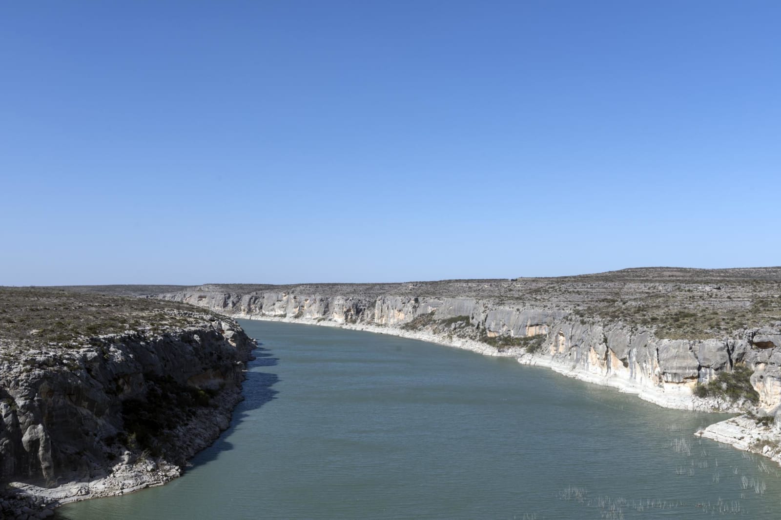
Carol M. Highsmith / public domain via the Library of Congress
A 6-Day Itinerary
The Texas Forts Trail and the Lower Pecos in 6 Days
From Abilene to Del Rio: Frontier Texas! and Buffalo Gap, the chimneys of Fort Phantom Hill, Albany and Fort Griffin, Fort Chadbourne and Fort Concho, Fort McKavett, the Caverns of Sonora, Fort Lancaster, Langtry, the Pecos gorge and Seminole Canyon.
6 days · 714 miles · best in spring & fall
Abilene, TX → Del Rio, TX
Twice, in the 1850s and after the Civil War, the army built a chain of posts across West Texas through country the Comanche (Numunuu), the Kiowa and other nations held. This trip follows part of the Texas Forts Trail and then the Pecos to the Rio Grande, about 715 miles in six days: from Abilene and Buffalo Gap to the chimneys of Fort Phantom Hill, Albany and Fort Griffin, south past Fort Chadbourne to San Angelo and Fort Concho, through Fort McKavett and the Caverns of Sonora to Fort Lancaster, and down to Langtry, the Pecos gorge, Seminole Canyon and Del Rio.
The forts were built to take that country for settlers, and most of the museums on the way tell it from the settlers' side; for the Comanche Nation's own account, its museum is in Lawton, Oklahoma. Buffalo Soldiers, the Black cavalry and infantry regiments formed after the war, served at Fort Griffin, Fort Concho, Fort McKavett and Fort Lancaster, where in 1867 some sixty troopers of the Ninth Cavalry held out against Kickapoo fighters and their allies who greatly outnumbered them. In the canyons where the Pecos, the Devils and the Rio Grande meet, people lived in rock shelters for thousands of years and painted murals on their walls, and the park at Seminole Canyon shows them only on guided tours.
1
Day 1
Abilene, Frontier Texas! and Buffalo Gap
40 mi · about 1.1 hrs driving · overnight in Abilene
Start downtown at Frontier Texas!, open from 9 beside the Texas and Pacific line. Abilene exists because ranchers and businessmen persuaded the railroad's townsite locator in 1880 to pass by Buffalo Gap, then the county seat, and cross their own land; lots went on sale in March 1881, and more than 300 sold in two days. The museum tells the frontier through actors on screen and a theater show of stampeding bison, storms and gunfights, and it calls its subject the lively mythology of the frontier, which is the settlers' telling. It doubles as the Texas Forts Trail's visitor center, so pick up the trail's maps here. After lunch drive south on FM 89, about twenty-five minutes, to Buffalo Gap Historic Village, open until 5 with last arrival at 4. The stone courthouse and jail of 1880 belonged to the county seat that Abilene took away in 1883, and since 1956 collectors have gathered nearly twenty old buildings from around West Texas beside them; the self-guided walk takes about an hour. Abilene State Park is ten minutes on, under pecans and elms along Elm Creek, with arched red sandstone buildings the Civilian Conservation Corps built in the 1930s and a bird blind on the trails. Abilene is about half an hour back.
2
Day 2
Fort Phantom Hill, Albany and Fort Griffin
80 mi · about 2.1 hrs driving · overnight in Albany
Leave Abilene by 9 for Fort Phantom Hill, about twenty-five minutes north by FM 600. Infantry arrived on the Clear Fork of the Brazos in November 1851 to build a post in horse country, and it never fought a battle; Penateka Comanche under Buffalo Hump, and Lipan, Wichita, Kiowa and Kickapoo groups, came to it to talk and trade. The troops marched out in April 1854, fire took the log walls soon after, and more than a dozen stone chimneys still stand among the trails. Here you meet the Forts Trail drive, which this trip follows north today and south tomorrow. FM 600 and US-180 lead east, a little under an hour, to Albany and the Old Jail Art Center, open at 11 in Shackelford County's stone jail of 1878. The county was short of cash, so the Scottish masons cut their initials into the blocks to make sure of their pay, and the museum's collection of more than 2,400 works runs from ancient Chinese tomb figures to Picasso, Klee and Modigliani. After lunch take US-283 north, about twenty-five minutes, to Fort Griffin, open until 4:30. Four companies of the Sixth Cavalry came onto this plateau above the Clear Fork in July 1867. The post was the hub of the frontier line and a supply base for Mackenzie in the Red River War of 1874, and Buffalo Soldiers and Tonkawa scouts rode out from it in the campaigns that broke Kiowa and Comanche power in northern Texas. The Tonkawa lived beside the post; their descendants are today's Tonkawa Tribe of Oklahoma. Ruins of the mess hall, barracks and bakery stand on the plateau, and the official state longhorn herd grazes nearby. Albany is twenty-five minutes back.
3
Day 3
Fort Chadbourne to Fort Concho and San Angelo
128 mi · about 2.8 hrs driving · overnight in San Angelo
Call Fort Chadbourne the day before, since its hours are not posted, then leave Albany by 8:30; it is about an hour and three quarters by TX-351, I-20 and US-277 to the ranch eleven miles northeast of Bronte. Two companies of the Eighth Infantry set it up beside Oak Creek in October 1852, and it later guarded a Butterfield Overland Mail station from 1858 until 1861. Thomas Lawson Odom began ranching around the ruins in 1877, and in 1999 his descendant Garland Richards and his wife Lana set up a foundation that has stabilized the walls and rebuilt the officers' quarters and the stage station; excavation there has produced over 500,000 artifacts. Water ran short at Chadbourne, and in 1867 the army moved to the forks of the Concho, an hour south on US-277. The Tenth Cavalry made Fort Concho its headquarters between 1875 and 1882, and men of every one of the four Black regiments served at the post. Its record also holds the stone corral where Mackenzie's troops kept more than 100 captured Native women and children for six months in 1872 and 1873. Arrive by 3:30, since the historic buildings close at 4:30. A block north, the San Angelo Museum of Fine Arts is free and stays open until 7 on Thursdays; it began in the fort's 1868 quartermaster building and is known for its national ceramics competition. End the day on the Concho River Walk, four miles of lit trail along the North Concho, rebuilt after residents voted a sales tax for it in 2004.
4
Day 4
Fort McKavett and the Caverns of Sonora
142 mi · about 3.3 hrs driving · overnight in Sonora
Leave San Angelo by 8:30 on US-277 and RM 2084, about an hour and a half, for Fort McKavett, open 8 to 5, with the self-guided walk until 4. The Eighth Infantry founded it near the head of the San Saba in 1852, and from 1869 Ranald Mackenzie's Black Forty-first Infantry rebuilt it in stone; William T. Sherman called it the prettiest post in Texas in 1871. Soldiers of all four Black regiments served here, and a Ninth Cavalry sergeant from here, Emanuel Stance, became the first African American soldier awarded the Medal of Honor in the years after the Civil War. After the army left in 1883, settlers moved into the empty buildings and lived in them until 1973, which is why so much survives; the visitor center is in the hospital of 1874. RM 864 runs south to I-10, about an hour and a quarter, and the Caverns of Sonora, on a ranch west of town. Cavers crossed a narrow ledge over a fifty-foot pit here in 1955 and found passages so densely decorated that the cave opened to the public in 1960 to stop the damage. The standard Crystal Palace tour, for no more than twelve people, covers close to two miles of passage, descends 155 feet by 360 stairs and lasts about an hour and three quarters, past helictites that twist sideways instead of hanging straight. Take a tour no later than about 3, and leave bags, food and drink in the car. Sonora is about forty minutes east.
5
Day 5
Fort Lancaster, Langtry and the Pecos
238 mi · about 4.9 hrs driving · overnight in Del Rio
This is the longest day. Leave Sonora by 7:45 on I-10 west and TX-290, a little over an hour, to Fort Lancaster, which opens at 9. Two companies of the First Infantry camped on Live Oak Creek in August 1855, close to the Pecos crossing on the lower San Antonio-El Paso road, and all three of the army's camel expeditions passed through, in 1857, 1859 and 1860. In December 1867 some sixty troopers of the Ninth Cavalry's Company K defended it against Kickapoo fighters and their allies who far outnumbered them, and three soldiers were killed; the Texas Historical Commission knows of no other Native attack on an army fort in Texas. More than 30 foundations remain on 82 acres, with little shade. By 11 take TX-290 and TX-349 south to Dryden and US-90 east to Langtry, about two and a half hours. The Pecos County commissioners made Roy Bean justice of the peace at the railroad camp of Vinegarroon in August 1882, and he held court in his saloon, the Jersey Lilly, until 1902. The Judge Roy Bean Visitor Center is being rebuilt, so for now you can see only its lobby and restrooms, open until 5; the saloon, the opera house and the gardens are shut. Back on US-90, the Pecos River Overlook is about twenty-five minutes east, at the northeast end of the bridge of 1957 high above the gorge. The bridge of 1923 below it sat only 50 feet above the water until the flood of 1954 took it. Del Rio is about an hour on.
6
Day 6
Seminole Canyon, Amistad and Del Rio
86 mi · about 1.8 hrs driving · overnight in Del Rio
Drive back west on US-90, about fifty minutes, to Seminole Canyon State Park for the Fate Bell Shelter tour you reserved; the office opens at 8:15. The shelter, about 150 yards long, was lived in for more than 8,000 years, and its Pecos River style paintings, some three to four thousand years old, are among the best preserved of their kind. The canyon may be entered only with a guide, and the tour is a fairly rugged hike. The rim trails are open to walk on your own. On the way back, stop at the visitor center of Amistad National Recreation Area on US-90, open 8 to 4:30, where the thirty-minute film Spirits of the Canyon introduces the paintings of the Lower Pecos. The dam the United States and Mexico finished in 1969 flooded many painted rock shelters on the Rio Grande and the Devils River. Del Rio grew on San Felipe Creek, fed by springs the Handbook of Texas ranks third largest in the state, and the irrigation canals a land company dug from it in the 1860s still run through town. The Whitehead Memorial Museum, open 1 to 5 on Sundays, sets old Del Rio buildings along one of them, from the Perry Store of 1870 to the office Dr. Simon Rodriguez, Del Rio's first Hispanic doctor, used from 1925, with exhibits on the Black Seminole scouts and border radio. Finish at Val Verde Winery, which Frank Qualia founded in 1883; the family kept the vines through Prohibition by selling table grapes, and the tasting room is open 1 to 5 on Sundays.
The drives this trip follows
Each one is traced end to end on its own page, with every stop worth making along the way.