US-26: The North Platte Valley, Ogallala to Scotts Bluff
About 148 miles up the North Platte from Ogallala to the Wyoming line: Ash Hollow, the Mormon landmarks past Lisco, Chimney Rock, Scotts Bluff and the Wildcat Hills, the Interstate Canal's fields and the Horse Creek council ground.
The Route at a Glance
West of the forks the emigrant roads ran up both banks of the North Platte, the 1847 Mormon pioneers on the north side and the Oregon and California trains on the south, with the river between them to Fort Laramie.
US-26 leaves Ogallala north with NE-61, which goes on to Kingsley Dam and Lake McConaughy, and swings west to Ash Hollow, where trains from the South Platte came down Windlass Hill to the river. West of Lisco the waysides at the Ancient Bluff Ruins mark where Brigham Young's advance party camped in 1847.
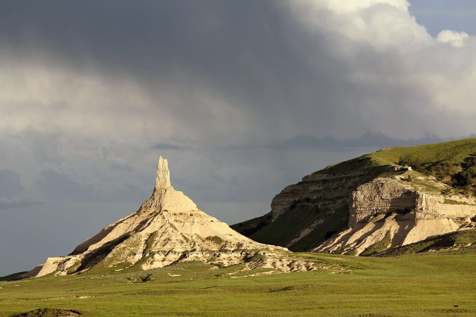
Courthouse and Jail Rocks stand five miles south of Bridgeport. From Bayard the route crosses to the south side on NE-92, past Chimney Rock to Gering and Scotts Bluff; NE-71 runs south from Gering into the pines of the Wildcat Hills. The fields here drink from the North Platte Project, authorized in 1903, whose Interstate Canal carries water ninety-five miles from Wyoming.
West of the pass, roads lead back to US-26 at Morrill. A marker west of town stands near the mouth of Horse Creek, where in September 1851 more than 10,000 Lakota, Cheyenne, Arapaho and others met government commissioners. The treaty granted roads and posts through their country for annuities Congress cut from fifty years to ten, and only one payment was made.
The drive runs about 148 miles, three hours without stops. Past Henry, US-26 goes on to Fort Laramie and the Emigrant Road.
The Drive, Stop by Stop
4 stops along the route, in driving order from Ogallala, Nebraska to Henry, Nebraska (Wyoming state line). One of them sits off the road itself — the distance is noted on each.
- 1
- 2
- 3
- 4
That's the drive. Take your time, pull over often, and let US-26: The North Platte Valley, Ogallala to Scotts Bluff do what it does best.
← Explore more of Open Road Guide