U.S. 12: The Lewis–Clark Valley Crossing
From the Nez Perce park at Spalding down the Clearwater to Lewiston, over the Snake into Clarkston, and south past Asotin to the rock art at Buffalo Eddy.
The Route at a Glance
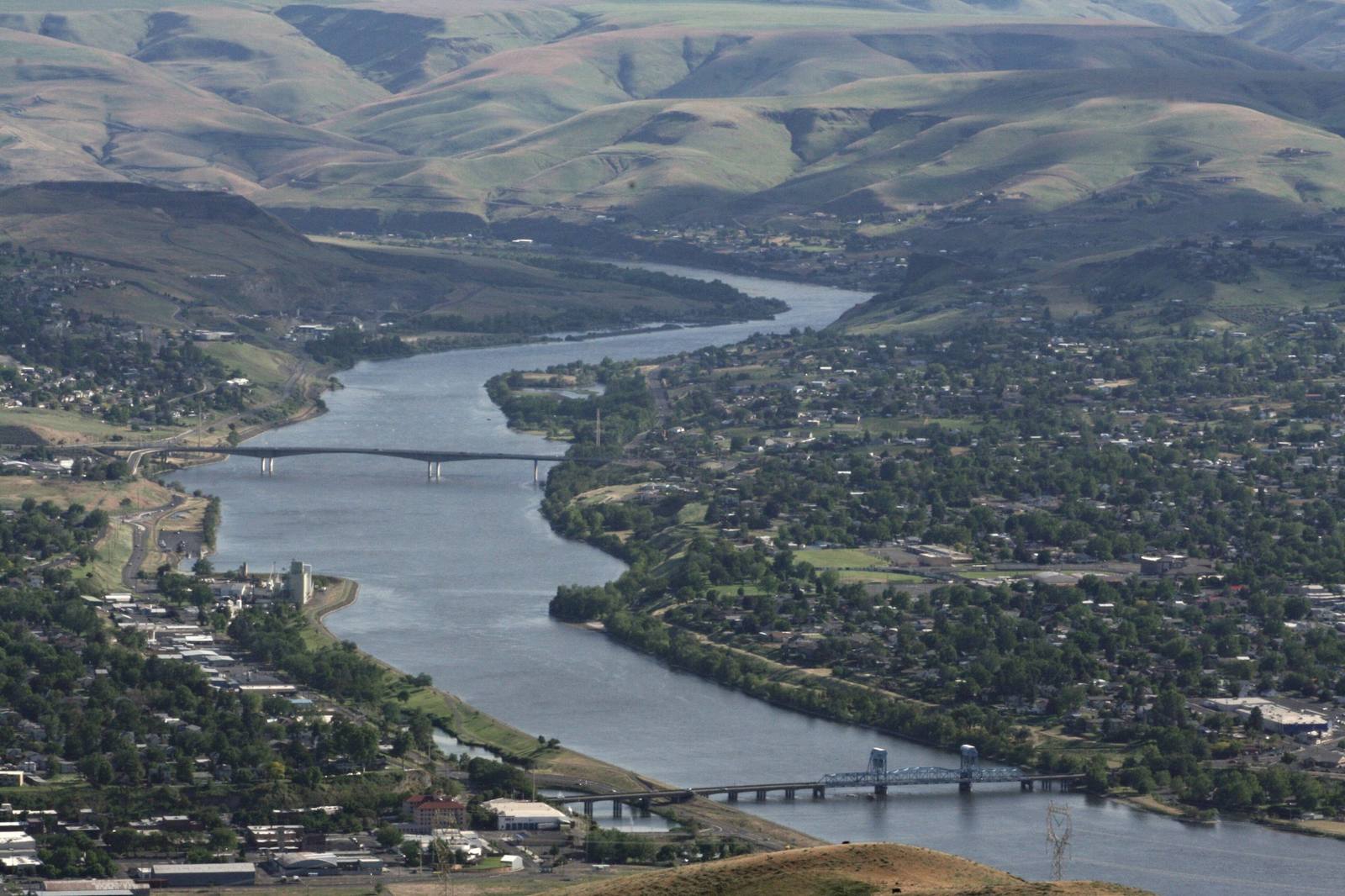
From Spalding, where Nez Perce National Historical Park keeps its visitor center above the mouth of Lapwai Creek, US-95 and US-12 run west together down the Clearwater, past the basalt on the canyon wall the Nimiipuu know as Coyote's Fishnet, to Lewiston, where the Clearwater meets the Snake.
Lewiston took Meriwether Lewis's name in 1861. Across the Snake, the bench was too high above the river for wells or ditches, and the few people on it called it Jawbone Flats and wintered horses there. In 1896 a group of Boston investors led by Charles Francis Adams, a grandson of John Quincy Adams, formed the Lewiston Water and Power Company, built a fourteen-mile canal and flume to bring Asotin Creek down onto the bench, and sold it as orchard land under the name Vineland. The town they platted was Concord, after the one in Massachusetts. A toll bridge to Lewiston opened in June 1899, and on January 1, 1900, after a local petition, the post office became Clarkston, so the two captains face each other across the river. US-12 crosses today on the Interstate Bridge, the blue vertical-lift span built in 1939.
SR-129 follows the Snake six miles south to Asotin, whose name comes from the Nimiipuu name for the creek there and the lamprey, eels to the settlers, that ran up it. Opposite, at the south end of Hells Gate State Park on the Idaho bank, shallow depressions in a field are what is left of Hesutiin, or Hasotino, one of the largest villages on the Snake and lived in until the end of the 1800s. Looking Glass's Alpowai band wintered near the creek mouth; in 1877 the younger Looking Glass took many of them into the war after the Army attacked his camp on Clear Creek.
Beyond Asotin the pavement continues as Snake River Road, between the water and the canyon wall, to Buffalo Eddy, where the river bends hard and the basalt on both banks carries images made by the ancestors of the Nimiipuu. The road goes on toward Heller Bar, where the Grande Ronde comes in at the lower end of Hells Canyon.
The drive is about 34 miles and an hour and a quarter without stops. Snake River Road is narrow and busy in summer, and parking at the eddy holds only a handful of cars.
The Drive, Stop by Stop
2 stops along the route, in driving order from Spalding, Idaho to Buffalo Eddy, Washington.
- 1
- 2
That's the drive. Take your time, pull over often, and let U.S. 12: The Lewis–Clark Valley Crossing do what it does best.
← Explore more of Open Road Guide