Home / South Carolina / Florence & the Pee Dee / South of the Border
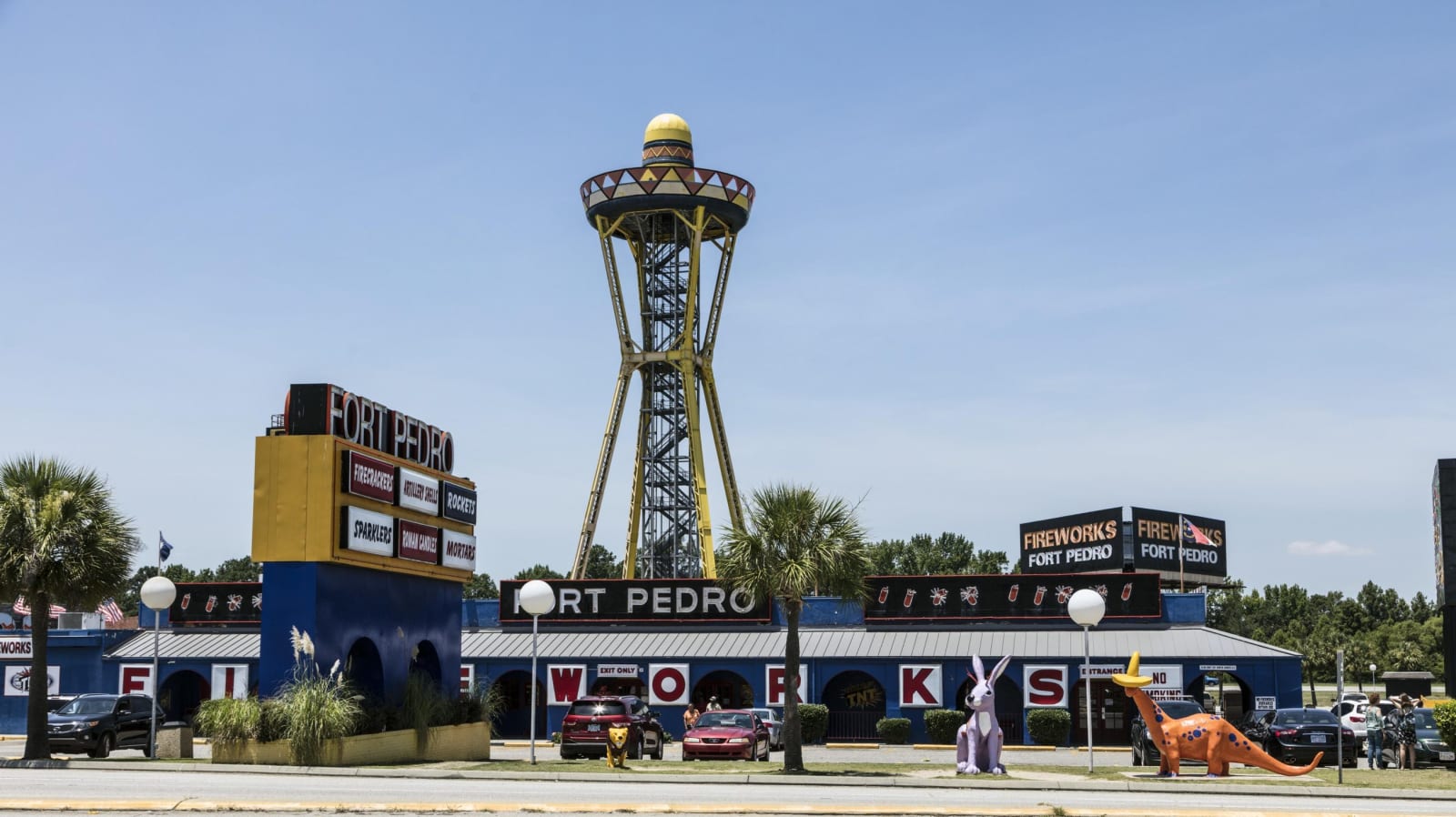
A blue fireworks store with yellow and red trim and a sign reading Fort Pedro, with a tall steel tower topped by a sombrero-shaped deck behind it under a blue sky.Carol M. Highsmith / public domain via Library of Congress
🛣️Roadside

South of the Border

Part ofFlorence & the Pee Dee

The faux-Mexican roadside stop on the North Carolina line, built from a 1950 beer stand into a 350-acre complex advertised by hundreds of miles of billboards.

⏱
Duration
Thirty minutes to an hour.
🎟
Admission
Free to stop; shops and rides charge separately.
📅
Best Season
Year round; open long hours for interstate traffic.

The Story

Alan Schafer, a Dillon beer distributor, put up a one-room beer stand on the state line around 1950 to sell to thirsty customers from dry Robeson County, North Carolina. Building supplies addressed to the "Schafer project: south of the border" gave it a name. A diner and a motel followed by 1954, fireworks from 1962, and when the route of I-95 was announced through the site in 1964, Schafer built for the interstate: a 97-foot neon sign, a 200-foot tower with a sombrero on top, and in time restaurants, shops, a campground and an amusement park on 350 acres.

The theme rests on a caricature. Schafer invented Pedro, a sombrero-wearing Mexican bandito who speaks in mock-broken English on billboards running from Virginia to Florida, and the early attractions included a Confederateland and a Pedro's Plantation. Many of the early billboards carried messages widely seen as racist; they have since been toned down while keeping the punning tone. Schafer denied the place was racist, pointing to his hiring of Black workers, his help for them in voting and his stand against the Ku Klux Klan.

The complex once employed 700 people, the most of any business in Dillon County, and still employs a few hundred. Walk under the sombrero tower, browse the fireworks stores, and note how the billboards counting down the miles have become a road-trip ritual of their own.

Visitor Info

⏱
Time Needed
Thirty minutes to an hour.
🎟
Admission
Free to stop; shops and rides charge separately.
📅
Best Season
Year round; open long hours for interstate traffic.
🛣️
Highway
I-95 and US 301/US 501

On the Map

Nearby

The closest stops worth working into your route

natural12 mi away
Little Pee Dee State Park
A quiet park on the blackwater Little Pee Dee River near Dillon, with a Carolina bay and its sand rim and a 54-acre lake for fishing and paddling.
cultural14 mi away
Museum of the Southeast American Indian at Old Main
The 1923 brick building at UNC Pembroke that Lumbee people fought to save, burned in 1973 and rebuilt, now home to a free museum of Native Southeast life.
historical16 mi away
Battle of Hayes Pond
The field near Maxton where several hundred Lumbee people broke up a Ku Klux Klan rally on January 18, 1958, marked by a state roadside marker.
natural19 mi away
Lumber River State Park (Princess Ann Access)
The blackwater river the Lumbee are named for, which many Lumbee people call the Lumbee River, with landings, campsites and trails at Princess Ann.
historical21 mi away
Laurinburg Institute
The Black boarding school Emmanuel and Tinny McDuffie founded in 1904 at Booker T. Washington's urging, where Dizzy Gillespie was a student from 1933.
cultural33 mi away
Florence County Museum
Florence's art and history museum, telling the Pee Dee region from its Native peoples to the 1958 Mars Bluff bomb, with a collection of the Florence-born painter William H. Johnson.

Historical markers nearby

Roadside plaques and monuments within a short detour

Marker5.4 mi away
Saint Paul Methodist Church
Little Rock
Marker6.3 mi away
Dillon Graded School and Dillon Public School
Dillon
Marker6.5 mi away
Town of Dillon
Dillon
Marker6.5 mi away
Dillon County
Dillon
Marker8.7 mi away
Leland Grove School
Clio vicinity
Marker11 mi away
Selkirk Farm
Manning Crossroads