Home / South Carolina / Florence & the Pee Dee / Little Pee Dee State Park
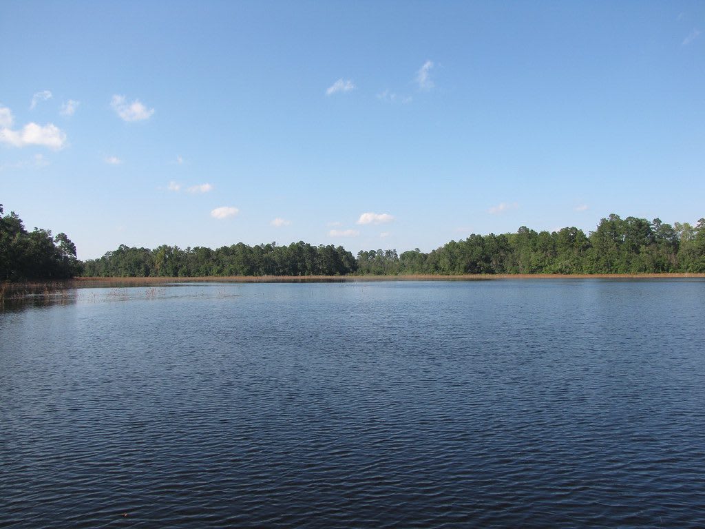
Dark, still water of a small lake stretching to a low line of pine and hardwood forest under a blue sky with scattered clouds.Gerry Dincher / CC BY-SA 2.0 via Flickr
🌲Natural

Little Pee Dee State Park

Part ofFlorence & the Pee Dee

A quiet park on the blackwater Little Pee Dee River near Dillon, with a Carolina bay and its sand rim and a 54-acre lake for fishing and paddling.

⏱
Duration
One to two hours; overnight in the campground.
🎟
Admission
Free admission (South Carolina State Parks, 2026).
📅
Best Season
Spring and fall; summer for the lake.

The Story

The river and the park take their name from the Pee Dee people, whose towns lay along the Pee Dee rivers before colonial wars and disease pushed the survivors to join the Catawba in the 1700s. The Little Pee Dee runs dark with tannin from the swamps that feed it, and the park takes in a piece of that swamp along with the sandhills above it.

Its odd feature is a Carolina bay, one of the oval, shallow basins that dot the coastal plain from Maryland to Florida, their long axes nearly all pointing northwest to southeast. Dillon and Horry counties have more of them than anywhere else. The most accepted explanation is that ice-age winds blowing across standing water shaped them; recent geological work reads them as old thaw lakes from a time when frozen ground reached this far south, and the meteorite theory popular in the 1930s has no support. Most bays were long ago logged, ditched and farmed, and only a few hundred are still protected, so the sand rim here, marking the edge of the basin, is worth the walk.

Lake Norton covers 54 acres behind a dam you can walk across, with a fishing pier and bream, bass and catfish. Canoes, kayaks and johnboats can be rented for the lake; private boats are limited to electric motors. With I-95 a short drive away, the shaded picnic areas and campground make an easy break from the interstate.

Visitor Info

⏱
Time Needed
One to two hours; overnight in the campground.
🎟
Admission
Free admission (South Carolina State Parks, 2026).
📅
Best Season
Spring and fall; summer for the lake.
🛣️
Highway
State Park Road (near I-95)

On the Map

Nearby

The closest stops worth working into your route

roadside12 mi away
South of the Border
The faux-Mexican roadside stop on the North Carolina line, built from a 1950 beer stand into a 350-acre complex advertised by hundreds of miles of billboards.
natural17 mi away
Lumber River State Park (Princess Ann Access)
The blackwater river the Lumbee are named for, which many Lumbee people call the Lumbee River, with landings, campsites and trails at Princess Ann.
cultural25 mi away
Museum of the Southeast American Indian at Old Main
The 1923 brick building at UNC Pembroke that Lumbee people fought to save, burned in 1973 and rebuilt, now home to a free museum of Native Southeast life.
historical27 mi away
Battle of Hayes Pond
The field near Maxton where several hundred Lumbee people broke up a Ku Klux Klan rally on January 18, 1958, marked by a state roadside marker.
historical29 mi away
Florence Stockade
The Confederate prison camp of 1864-65 outside Florence, where about 2,800 Union prisoners died, now a walking trail beside the national cemetery that began as their burial trenches.
cultural29 mi away
Florence County Museum
Florence's art and history museum, telling the Pee Dee region from its Native peoples to the 1958 Mars Bluff bomb, with a collection of the Florence-born painter William H. Johnson.

Historical markers nearby

Roadside plaques and monuments within a short detour

Marker7.9 mi away
Ebenezer Church
Temperance Hill vicinity
Marker7.9 mi away
Town of Dillon
Dillon
Marker8.1 mi away
Dillon County
Dillon
Marker8.1 mi away
Dillon Graded School and Dillon Public School
Dillon
Marker8.5 mi away
Mt. Olive Baptist Church
Mullins
Marker8.7 mi away
Tobacco Culture
Mullins