Home / Texas / Big Thicket & the Golden Triangle / Sea Rim State Park
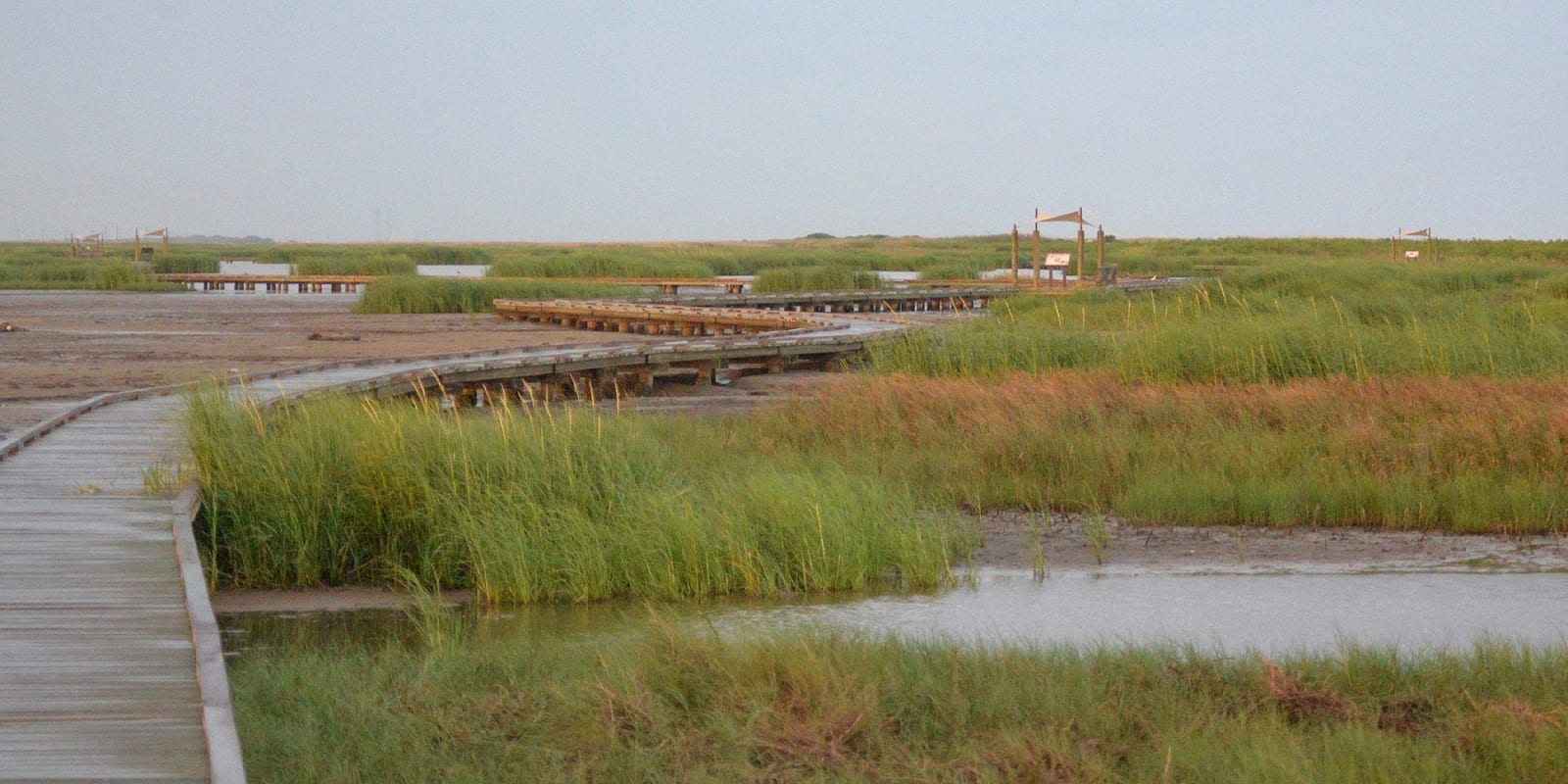
Gambusia Nature Trail boardwalk winding across tidal flats and marsh grass at Sea Rim State ParkWilliam L. Farr / CC BY 4.0 via Wikimedia Commons
🌲Natural

Sea Rim State Park

Part ofBig Thicket & the Golden Triangle

Texas's far southeast corner: nearly two miles of Gulf shoreline backed by 4,000 acres of marsh, reached by boardwalk or paddle trail, rebuilt after Rita and Ike.

⏱
Duration
Two to four hours; longer for a paddle trail.
🎟
Admission
Adults $4 per day; children 12 and under free.
📅
Best Season
Year round. Open daily 6 a.m. to 10 p.m.; busiest April through July, so reserve camping.

The Story

Sea Rim sits at the far southeast corner of Texas with nearly two miles of Gulf shoreline and some 4,000 acres of marsh behind it, according to Texas Parks and Wildlife. The way into the marsh is the Gambusia Nature Trail, a boardwalk, or by kayak or canoe on paddling trails that run from an easy 1.79 miles to an advanced 9.59. Alligators live here and mosquitoes never leave, so plan for both. The park lends wheelchairs and fishing gear, and fishing from the surf or the marsh edge needs no license inside a state park.

People have used this coast for a long time. The park's history places the Atakapa-Ishak, whom it calls the Atakapa, in Texas about 2,000 years ago, bringing pottery, and says most were gone by the 1820s. From the 1870s to the 1950s the land was a cattle ranch. Texas bought it in 1972 and the park opened in 1977.

Storms have shaped what you see. Hurricane Rita ravaged the park in 2005, and Ike arrived in September 2008, two weeks before a planned reopening. The park came back on a limited basis in 2010, with visitors bringing their own water, and in June 2014 staff unveiled a camping loop, a cabin, an elevated dune boardwalk and a walk-in day-use area. The park is open daily 6 a.m. to 10 p.m., and the busy season runs April through July.

Visitor Info

⏱
Time Needed
Two to four hours; longer for a paddle trail.
🎟
Admission
Adults $4 per day; children 12 and under free.
📅
Best Season
Year round. Open daily 6 a.m. to 10 p.m.; busiest April through July, so reserve camping.
🛣️
Highway
TX-87 (Gulfway Drive)

On the Map

Nearby

The closest stops worth working into your route

historical9.3 mi away
Sabine Pass Battleground State Historic Site
A waterfront park at the mouth of the Sabine where the earthwork of Fort Griffin stood, with a Dowling statue, a Union memorial, wartime magazines and a walkway for fishing.
cultural13 mi away
Museum of the Gulf Coast
Port Arthur's regional museum in a former bank building: fossils, Native Americans, the petroleum story, a 125-foot history mural and Halls of Fame for musicians, athletes and artists.
industrial23 mi away
Spindletop-Gladys City Boomtown Museum
A re-created oil boomtown on the Lamar University campus, with a derrick, period shops, a 1941 granite monument and an optional re-enactment of the January 1901 Lucas gusher.
architectural27 mi away
McFaddin-Ward House
A Beaux-Arts Colonial Revival mansion finished in 1906 and lived in by one family for 75 years, with free guided tours of three furnished floors, the carriage house and gardens.
cultural32 mi away
Stark Museum of Art
A white-marble museum in Orange built by the Stark Foundation and opened in 1978, holding Western art, American Indian art, Audubon's Birds of America and Steuben glass, free to enter.
natural32 mi away
Shangri La Botanical Gardens and Nature Center
More than 250 acres on Adams Bayou, begun by H. J. Lutcher Stark in 1937, with garden rooms, a cypress-tupelo swamp, a heronry blind and free pontoon tours in season.

Historical markers nearby

Roadside plaques and monuments within a short detour

Marker7.3 mi away
Benjamin Johnson
Sabine Pass
Marker7.3 mi away
Jacob Harmon Garner
Sabine Pass
Marker7.4 mi away
Kate Dorman
Sabine Pass
Marker7.4 mi away
Kate Dorman
Sabine Pass
Marker7.4 mi away
Sabine Pass Cemetery
Sabine Pass
Marker8.3 mi away
City of Sabine and Sabine Pass
Sabine Pass