Home / Texas / Georgetown, Corsicana & the Blackland Prairie / Petroleum Industry Park
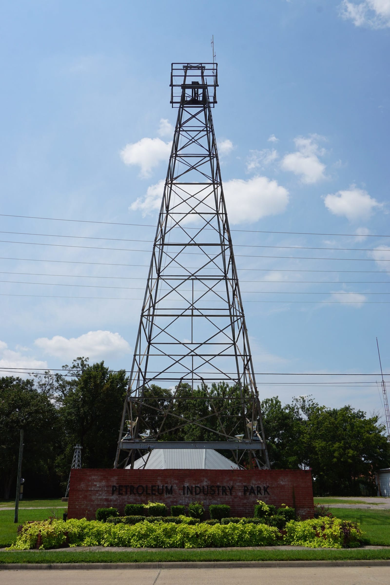
A steel drilling tower rising above a red-brick sign reading Petroleum Industry Park, with trimmed shrubs in front and a blue sky behind.Michael Barera / CC BY-SA 4.0 via Wikimedia Commons
🏭Industrial

Petroleum Industry Park

Part ofGeorgetown, Corsicana & the Blackland Prairie

The pipes and drilling tower mark where a city water well struck oil on June 9, 1894, the start of the first Texas field to produce oil and gas in important quantities.

⏱
Duration
About 30 minutes.
🎟
Admission
No admission listed; outdoor site.
📅
Best Season
Year round; an outdoor park.

The Story

On June 9, 1894, drillers from the American Well and Prospecting Company were sinking a water well for the city of Corsicana. At 1,027 feet they hit oil. The Handbook of Texas calls the Corsicana field the first in Texas to produce oil and gas in important quantities. One account says the contractor was annoyed that the well could not be plugged, though it showed the city the site held oil.

Local men and a Pennsylvania oilman formed the Corsicana Oil Development Company in September 1894, and John H. Galey agreed to drill five wells for half the leases. The first commercial well came in on October 15, 1895. Mayor James E. Whitesell brought in Joseph S. Cullinan in 1897; his refinery fired its stills at the end of 1898 and made its first shipment on February 24, 1899. On March 29, 1899, Texas passed its first law regulating how oil and gas wells are drilled, cased and plugged. The field peaked in 1900 at 839,554 barrels, and Corsicana gas fuelled Texas users until 1909.

The park sits in the 400 block of South 12th Street. It has historical markers, a drilling tower and two pipes, one marking the water well that struck oil and one the first successful commercial well. The Corsicana Preservation Foundation put up the discovery marker. It is an outdoor site with no admission listed.

Visitor Info

⏱
Time Needed
About 30 minutes.
🎟
Admission
No admission listed; outdoor site.
📅
Best Season
Year round; an outdoor park.
🛣️
Highway
I-45

On the Map

Nearby

The closest stops worth working into your route

cultural20 mi away
Blind Lemon Memorial Cemetery
The Freestone County grave of the Texas blues singer Blind Lemon Jefferson, who recorded for Paramount in Chicago from 1926 and died there in December 1929.
architectural30 mi away
Ellis County Courthouse
J. Riely Gordon's courthouse of 1897 in Pecos red sandstone and pink granite, with twenty-one carved stone faces and two cornerstones left by a quarrel over its building.
historical32 mi away
Confederate Reunion Grounds State Historic Site
Where Limestone County Confederate veterans gathered each summer from 1888, later a water supplier in the Mexia oil boom, now a Texas Historical Commission site on the Navasota River.
historical37 mi away
Old Fort Parker
A rebuilt 1830s family stockade near the Navasota River, where a May 1836 attack killed men of the Parker settlement and took five captives, among them nine-year-old Cynthia Ann Parker.
architectural39 mi away
Hill County Courthouse
Wesley C. Dodson's limestone Second Empire courthouse of 1890 on the Hillsboro square, gutted by fire on New Year's Day 1993 and rededicated in 1999 after a rebuilding that two Willie Nelson concerts helped pay for.
historical45 mi away
No. 1 British Flying Training School Museum
A free museum at Terrell's airport where about 2,200 RAF cadets learned to fly between 1941 and 1945, with logbooks, uniforms, letters and original training aircraft.

Historical markers nearby

Roadside plaques and monuments within a short detour

Marker0.1 mi away
Collin Street Bakery
Corsicana
Marker0.2 mi away
Capt. Charles Henry Allyn
Corsicana
Marker0.2 mi away
Early Texas Natural Gas Pipelines
Corsicana
Marker0.3 mi away
Samuel Wistar Johnson, M. D.
Corsicana
Marker0.3 mi away
Birthsite of Beauford H. Jester
Corsicana
Marker0.3 mi away
The First National Bank of Corsicana
Corsicana