Home / Arkansas / Fort Smith & the Arkansas River Valley / Petit Jean State Park
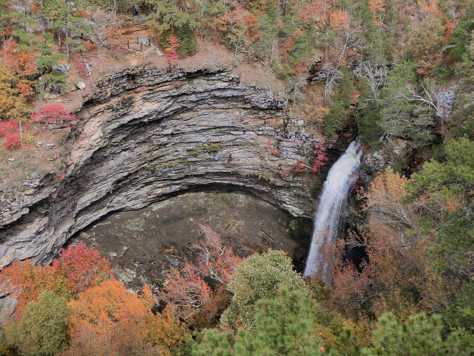
Cedar Falls dropping into a curved sandstone canyon at Petit Jean State Park in autumn colourMarcus O. Bst, CC BY-SA 2.0, via Wikimedia Commons
🏕️Recreational

Petit Jean State Park

Part ofFort Smith & the Arkansas River Valley

Arkansas's first state park, founded in 1923, with a Civilian Conservation Corps lodge, Cedar Falls and a Trail of Tears overlook on a canyon-cut mountain.

⏱
Duration
Half a day to a weekend.
🎟
Admission
No park entry fee is listed; lodging, cabins, campsites and some activities are charged.
📅
Best Season
Spring and fall for the trails; the visitor center is open daily 8 a.m. to 5 p.m. and closed New Year's Day, Thanksgiving, Christmas Eve and Christmas (state parks site, November 2026).

The Story

Petit Jean was Arkansas's first state park, and it began with a lumber company's doctor. In April 1907 officials of the Fort Smith Lumber Company toured their holdings, reached the Natural Bridge in the Seven Hollows area and began arguing over the cost of logging such rough ground. Their physician, Thomas William Hardison, later recalled that the idea came to him that the trees should be left alone and made into a park. He first campaigned for a national park, which ended in 1921 when National Park Service director Stephen Mather judged the tract too small. The state legislature established Petit Jean State Park in 1923.

From 1933 to 1941 the Civilian Conservation Corps built the park's roads, bridges, lakes, trails and rustic buildings. The company here was made up mostly of World War I veterans, and a visiting CCC official in 1934 judged it the best camp in Arkansas. Mather Lodge is the only lodge the CCC built in an Arkansas state park. The Cedar Falls Trail, about two miles round trip from behind the lodge, is a National Historic District. A CCC rock dam forms Lake Bailey.

In the 1830s the Cherokee and members of other southeastern nations passed Petit Jean Mountain on the forced journey to present-day Oklahoma, and a portion of that route can be seen from the overlook at Stout's Point. The park has more than 20 miles of trails, and its visitor center, named for Hardison, opened in December 2020.

Visitor Info

⏱
Time Needed
Half a day to a weekend.
🎟
Admission
No park entry fee is listed; lodging, cabins, campsites and some activities are charged.
📅
Best Season
Spring and fall for the trails; the visitor center is open daily 8 a.m. to 5 p.m. and closed New Year's Day, Thanksgiving, Christmas Eve and Christmas (state parks site, November 2026).
🛣️
Highway
AR 154

On the Map

Nearby

The closest stops worth working into your route

attraction1.7 mi away
Museum of Automobiles
Winthrop Rockefeller's 1964 museum on Petit Jean Mountain: a cable-roofed hall of antique cars, the only known Arkansas-built Climber, and vehicles once owned by Presidents and Elvis.
natural10 mi away
Holla Bend National Wildlife Refuge
A 7,000-acre refuge on an island of former farmland made when the Corps cut off a bend of the Arkansas River in 1954, with winter ducks, geese and eagles and a 14-mile auto tour.
recreational19 mi away
Lake Dardanelle State Park
A park on a 34,300-acre Arkansas River reservoir at Russellville, with aquarium exhibits and the story of the Norristown ferry crossing used in the removal of five nations.
recreational20 mi away
Mount Nebo State Park
Arkansas's second state park, on a flat-topped mesa above Dardanelle: a Victorian summer town, a town run by women in 1924, CCC cabins and a Trail of Tears view.
natural31 mi away
Pinnacle Mountain State Park
A day-use state park west of Little Rock around a 1,011-foot Ouachita peak, with a strenuous summit trail, the Arkansas Arboretum and a visitor center above the Arkansas River.
recreational38 mi away
Lake Ouachita State Park
The state park on Arkansas's largest lake, built around a spring a homesteader called healing in 1875.