Home / North Carolina / Asheville & the Blue Ridge / Craggy Gardens
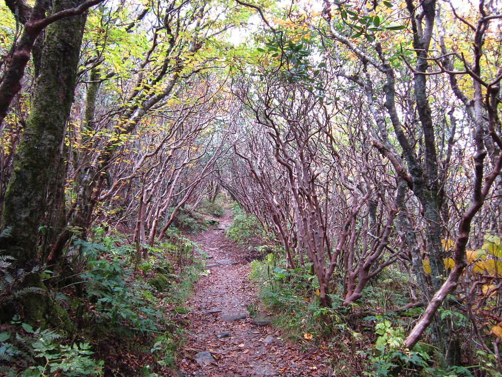
A narrow trail running through a tunnel of low, twisted rhododendron branches at Craggy Gardens.Selena N. B. H. / CC BY 2.0 via Flickr
🌲Natural

Craggy Gardens

Part ofAsheville & the Blue Ridge
On this driveThe Blue Ridge Parkway: Blowing Rock, Linn Cove, Linville Falls and Craggy Gardens

Rhododendron balds and wind-bent trees on the Great Craggy Mountains, along the Blue Ridge Parkway northeast of Asheville.

⏱
Duration
One to two hours.
🎟
Admission
Free (NPS, 2026).
📅
Best Season
Mid-June for rhododendron bloom, summer for cool air, fall for color; the visitor center and picnic area open seasonally, and the high Parkway closes in ice and snow. Check the Parkway road status first.

The Story

The Great Craggy Mountains run about fourteen miles northeast of Asheville, a small range of the Blue Ridge whose crest reaches 6,105 feet at Craggy Dome. The high slopes are heath balds, open ground covered in Catawba rhododendron and blueberry, edged by northern hardwoods such as beech, buckeye, mountain ash and red oak that wind and ice have twisted low. Fog and wind are common on the crest, and the rhododendron turns the balds purple around mid-June.

The Blue Ridge Parkway follows the crest for most of its way between Asheville and Mount Mitchell, and Craggy Gardens is its stop near milepost 364, with a visitor center, a picnic area and trails into the balds. The walk to Craggy Pinnacle, about 0.7 mile and roughly twenty minutes, ends at a stone-walled overlook with a view all the way around. Other trails meet the Mountains-to-Sea Trail. The high crest is cold: dress in layers for sunrise or sunset, when the wind picks up.

Helene closed the Parkway here in 2024. In November 2026 the road is open from Asheville north past the Folk Art Center and Bull Gap to the Craggy Gardens picnic area, but the stretch from just south of the Craggy tunnel past the visitor center to NC 128 is shut in winter weather, and beyond Mount Mitchell's entrance the Parkway north to NC 80 is still closed for Helene repairs. The visitor center and picnic area open seasonally.

Visitor Info

⏱
Time Needed
One to two hours.
🎟
Admission
Free (NPS, 2026).
📅
Best Season
Mid-June for rhododendron bloom, summer for cool air, fall for color; the visitor center and picnic area open seasonally, and the high Parkway closes in ice and snow. Check the Parkway road status first.
🛣️
Highway
Blue Ridge Parkway (milepost 364)

On the Map

Nearby

The closest stops worth working into your route

natural7.9 mi away
Mount Mitchell State Park
The highest summit east of the Mississippi, named for the professor who measured it and died proving it, and North Carolina's first state park in 1915.
historical12 mi away
Thomas Wolfe Memorial
Julia Wolfe's boardinghouse on Market Street in Asheville, the Old Kentucky Home her son turned into Dixieland in Look Homeward, Angel.
cultural12 mi away
YMI Cultural Center
The 1893 Young Men's Institute on Eagle Street in Asheville, built for the Black men who worked on Biltmore and kept by Black Asheville ever since.
historical13 mi away
Biltmore Estate
George Vanderbilt's 1895 house south of Asheville, built by about a thousand workers on land bought from Shiloh, a Black community the estate moved a mile away.
natural20 mi away
Chimney Rock State Park
A 315-foot gneiss spire over Hickory Nut Gorge and Lake Lure, run as a family attraction for a century, now a state park reopened after Helene.
historical22 mi away
Marion Mill Strike of 1929
The East Marion mill yard where sheriff's deputies shot striking textile workers on October 2, 1929, killing six workers.

Historical markers nearby

Roadside plaques and monuments within a short detour

Marker6.5 mi away
Montreat College
Black Mountain
Marker6.7 mi away
Black Mountain College
Black Mountain
Marker6.7 mi away
Andre Michaux
Black Mountain
Marker6.7 mi away
Geodesic Domes
Black Mountain
Marker7.1 mi away
Rafael Guastavino
Black Mountain
Marker7.1 mi away
Mount Mitchell Railroad
Black Mountain