Home / Texas / Amarillo & Route 66 / Cadillac Ranch
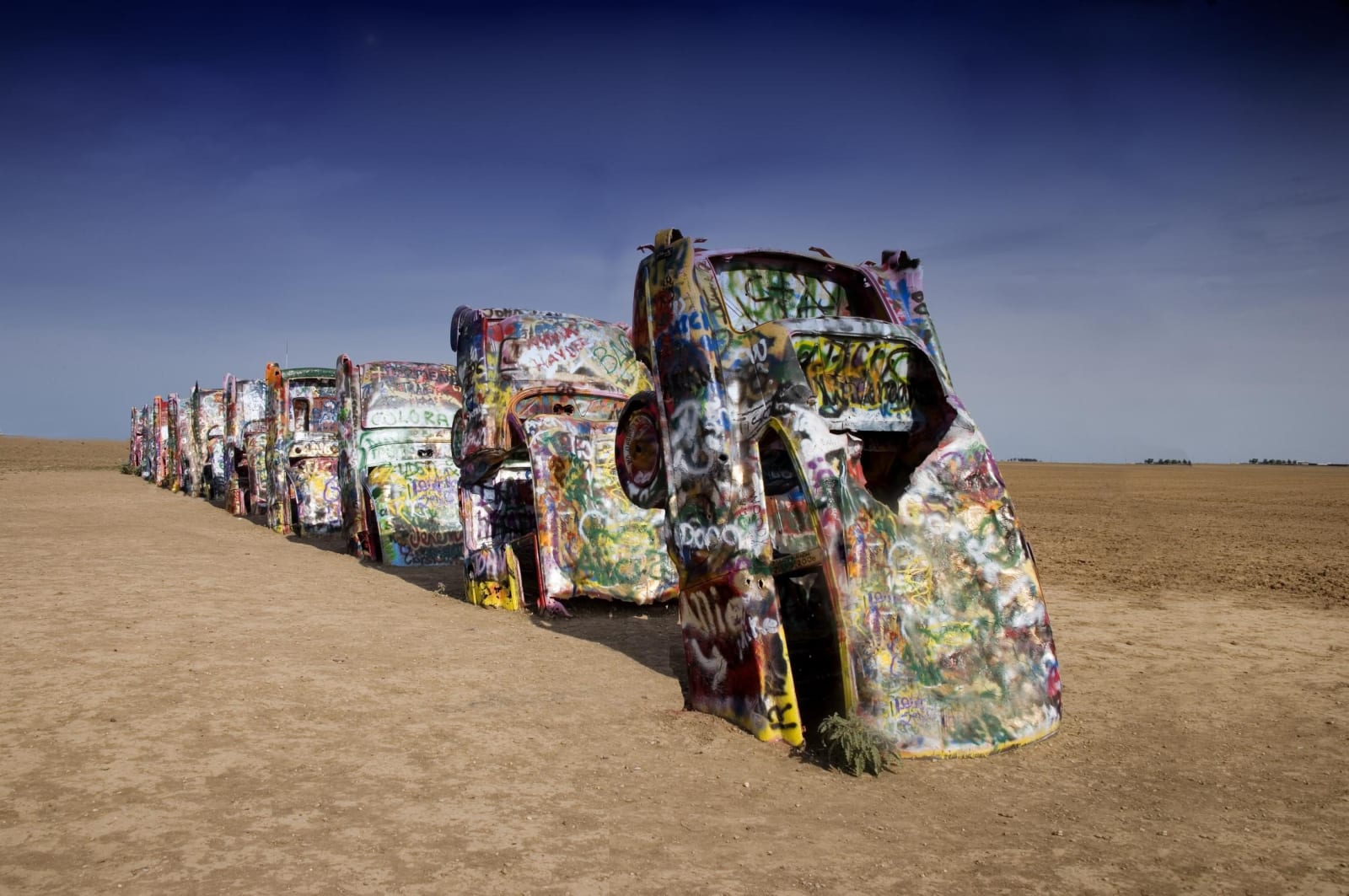
A row of graffiti-covered Cadillacs buried nose down in bare dirt at Cadillac Ranch under a deep blue sky.Carol M. Highsmith / public domain via the Library of Congress
⭐Attraction

Cadillac Ranch

Part ofAmarillo & Route 66

Ten Cadillacs from 1949 to 1963 planted nose down in a pasture west of Amarillo by the Ant Farm collective in 1974, on private land where visitors are let in to paint them.

⏱
Duration
Thirty minutes.
🎟
Admission
Free. Private land, open by the owners' leave.
📅
Best Season
Year round, in daylight. The pasture is muddy after rain.

The Story

In 1974 three members of Ant Farm, an alternative architecture group, buried ten Cadillacs nose first in a wheat field west of Amarillo. Chip Lord, Hudson Marquez and Doug Michels wanted to show the rise and fall of the tail fin, and the cars span the model years from 1949 to 1963. Their patron was Stanley Marsh 3, an Amarillo millionaire who answered their proposal by saying it was so silly he wanted to give it all his time and attention. He found the cars by advertising for used Cadillacs under the name Leo Wyoming.

In 1997 the whole row was quietly dug up and replanted about two miles farther west, in a pasture along Interstate 40, to keep it ahead of the growing city. Both sites were Marsh land. Over the years the cars have been painted white for a commercial, pink for a birthday, black when Doug Michels died, and then over and over by visitors. Spray paint is now expected, and the original colors are long gone.

The ranch is private land with no staff, hours or fee. Visitors park along the I-40 south frontage road and walk in through a gate and across the pasture, by the owners' leave. The field is muddy after rain. Bring paint if you want to add to it, and carry your empty cans back out.

Visitor Info

⏱
Time Needed
Thirty minutes.
🎟
Admission
Free. Private land, open by the owners' leave.
📅
Best Season
Year round, in daylight. The pasture is muddy after rain.
🛣️
Highway
I-40 (south frontage road)

On the Map

Nearby

The closest stops worth working into your route

industrial4.3 mi away
Helium Centennial Time Columns Monument
Four sealed time capsules raised in Amarillo in 1968 for helium's centennial, in the city that for years produced almost all the world's commercial helium from the Cliffside field.
architectural7 mi away
Route 66 Sixth Street Historic District
Thirteen blocks of Amarillo's streetcar suburb that Route 66 turned into a roadside strip, from the 1922 Nat to Texaco, Phillips and Dutch Mill stations, now shops and bars.
cultural15 mi away
Panhandle-Plains Historical Museum
The Panhandle's great collection, some two million objects behind a 1933 Art Deco hall carved with cattle brands, closed to the public since March 2025 over fire-safety violations.
natural20 mi away
Buffalo Lake National Wildlife Refuge
A 1938 Depression-era lake on Tierra Blanca Creek that has gone dry, now 7,664 acres of shortgrass, cottonwood canyon and a prairie dog town on the High Plains south of Umbarger.
natural22 mi away
Palo Duro Canyon State Park
The upper end of the canyon the state bought in 1933, where CCC crews built the road to the floor and the army burned the winter camps of the Comanche, Kiowa and Cheyenne in 1874.
cultural23 mi away
TEXAS Outdoor Musical
A summer pageant of Panhandle settler life staged since 1966 in the Pioneer Amphitheater, built into a basin of Palo Duro Canyon below a 600-foot cliff.

Historical markers nearby

Roadside plaques and monuments within a short detour

Marker3.4 mi away
Amarillo
Amarillo
Marker4.2 mi away
Helium Time Columns Monument and Museum
Amarillo
Marker4.3 mi away
Frying Pan Ranch
Bushland
Marker7 mi away
Amarillo Natatorium ("The Nat")
Amarillo
Marker7 mi away
Route 66 in Amarillo
Amarillo
Marker7.9 mi away
St. Mary's Academy
Amarillo