Home / Tennessee / The Upper Cumberland / Burgess Falls State Park
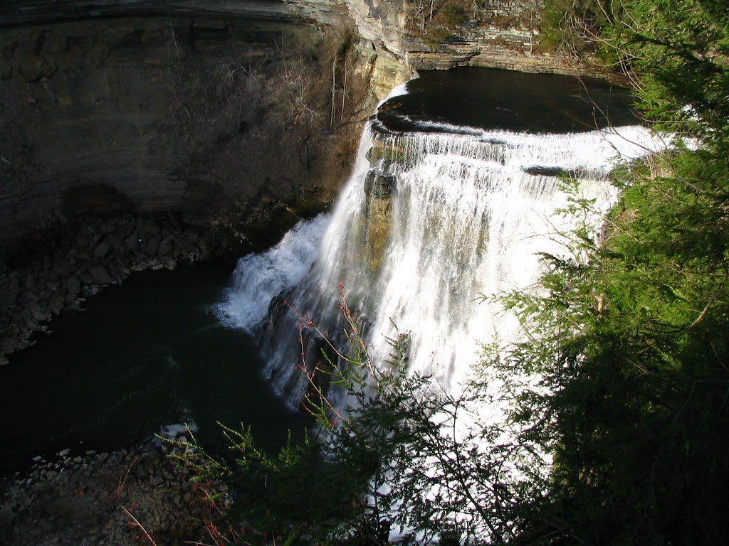
A broad waterfall spills over a curved rock lip into a dark pool in a limestone gorge.SeeMidTN.com (Brent) / CC BY 2.0 via Flickr
🌲Natural

Burgess Falls State Park

Part ofThe Upper Cumberland

A day-use park on the Falling Water River, where a short trail passes three smaller falls on its way to a drop of more than 130 feet into a limestone gorge.

⏱
Duration
One to two hours.
🎟
Admission
No entrance fee at Tennessee state parks (Tennessee State Parks, 2026).
📅
Best Season
Year round; the park closes on days of heavy rain because the river rises fast. Spring after rain has the most water.

The Story

The Falling Water River drops from about 900 feet on the Highland Rim to just over 600 at Center Hill Lake, and it does most of that in the last stretch before the lake. A short trail follows the river down past a low cascade, Little Falls and Middle Falls, then reaches the main fall, which plunges more than 130 feet into a limestone gorge with walls 100 to 200 feet high. Each drop is larger than the one before it.

The name comes from Tom Burgess, who received this land as a Revolutionary War grant. His family used the rapids to run a grist mill and later a sawmill. In 1924 the city of Cookeville built a dam upstream to make its own electricity. A flood destroyed it four years later, and the city rebuilt it in concrete. The plant stopped generating in 1944, but the dam still holds back the lake above the falls, and part of a pipeline bridge from the power scheme still crosses the river near Little Falls.

Cookeville residents pushed to protect the place. The city and the state agreed on shared management in 1950, and the state formally created the natural area in 1971. It is a day-use park with trails, a playground and picnic ground. The river is volatile, so the gates close on days of heavy rain, and the best view is a day or two after a storm rather than during one.

Visitor Info

⏱
Time Needed
One to two hours.
🎟
Admission
No entrance fee at Tennessee state parks (Tennessee State Parks, 2026).
📅
Best Season
Year round; the park closes on days of heavy rain because the river rises fast. Spring after rain has the most water.
🛣️
Highway
Burgess Falls Drive

On the Map

Nearby

The closest stops worth working into your route

historical9.7 mi away
Cookeville Depot Museum
The 1909 Tennessee Central Railroad depot in Cookeville's west side, now a museum with a model of the town in 1955 and a steam engine in the yard.
natural15 mi away
Cummins Falls State Park
A 75-foot waterfall and swimming hole on the Blackburn Fork, saved from a housing development in 2011 and opened as Tennessee's 54th state park.
natural16 mi away
Rock Island State Park
A park where the Collins, Rocky and Caney Fork rivers meet at the head of Center Hill Lake, with a gorge of waterfalls below a 1917 dam and the remains of a cotton-mill town.
cultural29 mi away
Muddy Pond Mennonite Community
A Mennonite farming community in Overton County near Monterey, known for sorghum syrup pressed and boiled each fall and for the farm stores along its roads.
natural30 mi away
Fall Creek Falls State Park
A New Deal park on the western edge of the Cumberland Plateau, where Cane Creek has cut a gorge and a 256-foot waterfall drops into it.
historical31 mi away
Standing Stone State Park
A New Deal park on Mill Creek named for a vanished stone that Native peoples revered and railroad builders blasted, with a lake, 1930s cabins and a marbles championship.

Historical markers nearby

Roadside plaques and monuments within a short detour

Marker6.3 mi away
Eli Sims (Simms) February 1, 1776-September 14, 1862
Sparta
Marker6.9 mi away
The Walton Road
Cookeville
Marker7.2 mi away
Richard Fielding Cooke
Cookeville
Marker9.4 mi away
Putnam County's Only Public Execution
Cookeville
Marker9.5 mi away
Darwin School
Cookeville
Marker9.8 mi away
Capshaw School
Cookeville