Home / Texas / Amarillo & Route 66 / Alibates Flint Quarries National Monument
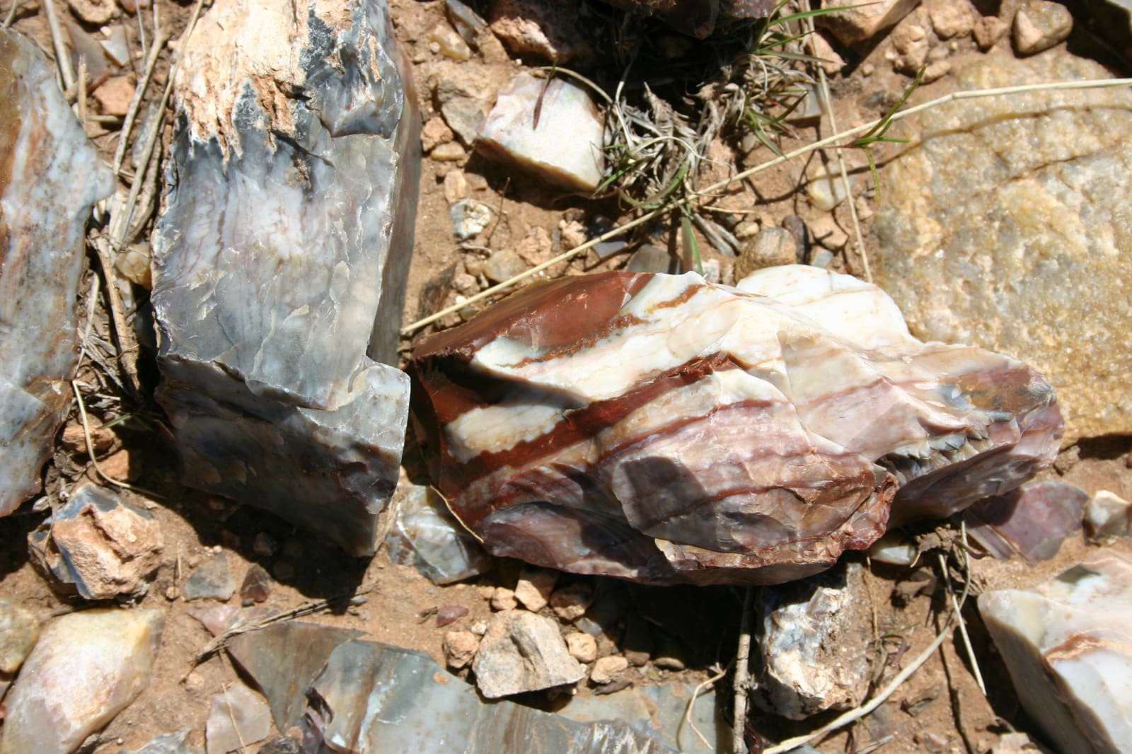
A banded chunk of maroon and white Alibates flint lying among loose rocks and dry grass.NPS / public domain
๐Ÿ›๏ธHistorical

Alibates Flint Quarries National Monument

Part ofAmarillo & Route 66

Hand-dug pits on a mesa above the Canadian River where people quarried banded flint for thousands of years and traded it across the Plains, seen on a ranger-led climb.

โฑ
Duration
Two and a half to three hours with the tour.
๐ŸŽŸ
Admission
Free, including ranger tours.
๐Ÿ“…
Best Season
The visitor center is open daily 9 a.m. to 4 p.m., closed Thanksgiving and Christmas. Quarry tours by reservation (806-886-3826); the program season runs April through October.

The Story

Alibates flint is an agatized dolomite, usually banded maroon and white, sometimes blue, brown, red or yellow, and it outcrops along both sides of the Canadian River north of Amarillo. The National Park Service dates its use to mammoth hunters some 13,000 years ago, and people kept working it for thousands of years after. The flint is richest on a 60-acre stretch of mesa top, and more than 736 hand-dug quarry pits remain, each a depression more than six feet across where diggers went a foot or more down to unweathered stone.

Between about 1150 and 1450, Plains Village people, likely ancestors of the Caddo, Pawnee and Wichita, lived in stone-walled villages along the river and worked the flint into blades and blanks for trade. Alibates tools turned up across the Great Plains and as far as Canada and Mexico, and the villagers took in Pueblo pottery from the Rio Grande, obsidian from the Jemez Mountains, pipestone from Minnesota and shells from the Pacific. The monument, set aside in 1965, was the first national monument in Texas.

The quarries can be seen only with a ranger. Tours leave the visitor center at 10 a.m., or 9 a.m. in summer, by reservation, and climb about 170 feet over two miles in roughly two hours. Wear long pants and closed-toe shoes, and expect cancellations in bad weather. The visitor center, open daily, has exhibits on the flint and its trade. Collecting, digging and metal detecting are illegal.

Visitor Info

โฑ
Time Needed
Two and a half to three hours with the tour.
๐ŸŽŸ
Admission
Free, including ranger tours.
๐Ÿ“…
Best Season
The visitor center is open daily 9 a.m. to 4 p.m., closed Thanksgiving and Christmas. Quarry tours by reservation (806-886-3826); the program season runs April through October.
๐Ÿ›ฃ๏ธ
Highway
TX-136 / Cas Johnson Road

On the Map

Stories

A story featuring this place

Go deeper into the history and character of this stop

History
The Buried City on Wolf Creek
Open Road Guide ยท 3 min read

Nearby

The closest stops worth working into your route

recreational7.9 mi away
Lake Meredith National Recreation Area
A Canadian River reservoir in 200-foot breaks, built to water the Panhandle's cities, that fell to a record 26 feet deep in 2013 and still rises and falls with the drought.
historical19 mi away
Hutchinson County Museum
Borger's museum on the three-mile Main Street of a 1926 oil boom town that drew 45,000 people in ninety days and was put under martial law in 1929.
historical24 mi away
Window on the Plains Museum
Moore County's free museum on the Dumas highway, telling an industrial Panhandle of zinc smelters, helium and gas plants alongside the farm and ranch rooms.
historical24 mi away
Carson County Square House Museum
The 1880s ranch cottage that is the oldest house in the town of Panhandle, at the heart of a twenty-one-building museum of the plains from mammoth hunters to the oil boom.
architectural27 mi away
Route 66 Sixth Street Historic District
Thirteen blocks of Amarillo's streetcar suburb that Route 66 turned into a roadside strip, from the 1922 Nat to Texaco, Phillips and Dutch Mill stations, now shops and bars.
industrial29 mi away
Helium Centennial Time Columns Monument
Four sealed time capsules raised in Amarillo in 1968 for helium's centennial, in the city that for years produced almost all the world's commercial helium from the Cliffside field.

Historical markers nearby

Roadside plaques and monuments within a short detour

Marker1.5 mi away
The Canadian River
Amarillo
Marker7.9 mi away
Exploration Route of Lt. James W. Abert
Marker10 mi away
Antelope Creek Ruins
Marker12 mi away
The Canadian River
Amarillo
Marker12 mi away
Great Spanish Road, First Ranch in Potter County, First Store in Potter County
Amarillo
Marker12 mi away
First Cemetery in Potter County
Amarillo