Home / Tennessee / Reelfoot Lake & Northwest Tennessee / Reelfoot National Wildlife Refuge
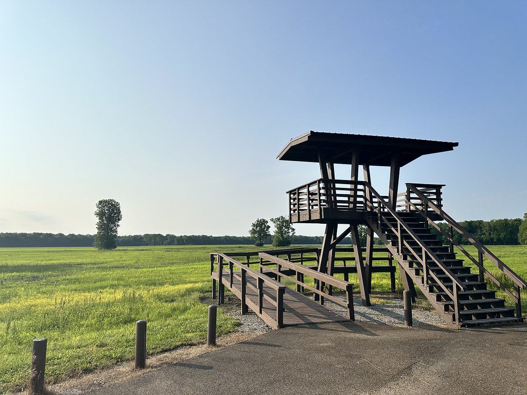
A wooden viewing tower with a staircase beside a paved path, looking out over open green wetland fields at Reelfoot National Wildlife Refuge.SlapTheWorld / CC0 via Flickr
🌲Natural

Reelfoot National Wildlife Refuge

Part ofReelfoot Lake & Northwest Tennessee

The federal refuge around Reelfoot Lake, with a visitor center, a 3.5-mile auto tour, viewing towers and canoe trails, on land the Chickasaw gave up in 1818.

⏱
Duration
One to three hours.
🎟
Admission
Free (U.S. Fish and Wildlife Service, 2026).
📅
Best Season
Late fall through winter for waterfowl; spring for migrating songbirds.

The Story

Most visitors see Reelfoot Lake from the state park side. The national wildlife refuge holds much of the rest: lands around the lake that are not in the state park, set aside by the federal government in 1941 and expanded since. The visitor center has exhibits and volunteers, a 3.5-mile auto tour loops through the bottomland hardwoods, and viewing towers look out over water that the 1811-12 earthquakes left behind. If you have a canoe or kayak, the refuge keeps marked canoe trails across the still, cypress-edged water. Birders and photographers come for waterfowl in the cold months. Some of the refuge is farmland leased under stricter soil rules than private owners once used, meant to slow the silt that would otherwise fill the lake.

Under the water and the soybeans, this was Chickasaw (Chikasha) country. The Chickasaw hunting range took in all of West Tennessee, and the treaties of 1805, 1816 and 1818 stripped it away. Historians say Andrew Jackson and the other commissioners used threats, economic coercion and bribery to get nearly 20 million acres, and that the 1818 agreement, the Jackson Purchase, ended every remaining Chickasaw claim in Tennessee. Gibson and Carroll counties, among others, were cut from that cession.

Removal followed after the Indian Removal Bill of 1830. Most of the Chickasaw crossed the Mississippi in 1837 and 1838, after great suffering, and the Chickasaw Nation is now centered in Oklahoma. The refuge is a quiet place to think about who the land belonged to first.

Visitor Info

⏱
Time Needed
One to three hours.
🎟
Admission
Free (U.S. Fish and Wildlife Service, 2026).
📅
Best Season
Late fall through winter for waterfowl; spring for migrating songbirds.
🛣️
Highway
Tennessee Highway 157

On the Map

Nearby

The closest stops worth working into your route

natural9.4 mi away
Reelfoot Lake State Park
A shallow cypress lake in the northwest corner of Tennessee, left by the 1811-12 New Madrid earthquakes and fought over by the Night Riders in 1908.
historical9.7 mi away
Island No. 10 and Tiptonville
A roadside marker north of Tiptonville for the 1862 river battle that opened the Mississippi toward Memphis, on an island the river has since erased.
cultural10 mi away
Carl Perkins Visitors Center
A restored caboose in Tiptonville telling the story of Carl Perkins, the sharecropper's son from Lake County who wrote Blue Suede Shoes.
cultural13 mi away
Discovery Park of America
A large museum and 50-acre heritage park in Union City, built on the old Obion County Museum, with Native American, earthquake and regional history galleries.
natural14 mi away
Big Oak Tree State Park
The last piece of the Bootheel's old bottomland forest, saved in 1938 with schoolchildren's dimes, with a cypress swamp and trees that top 130 feet.
historical14 mi away
Mt. Zion CME Church
Union City's 1896 brick church built by its Black congregation, the oldest surviving example of African American craftsmanship in town, listed on the National Register.

Historical markers nearby

Roadside plaques and monuments within a short detour

Marker11 mi away
General Clifton Bledsoe Cates
Tiptonville
Marker15 mi away
New Madrid
Missouri
Marker19 mi away
Otho French Strahl
Dyersburg
Marker26 mi away
The University of Tennessee at Martin
Martin
Marker27 mi away
Banks P. Turner
Yorkville
Marker27 mi away
Caruthersville
Missouri